
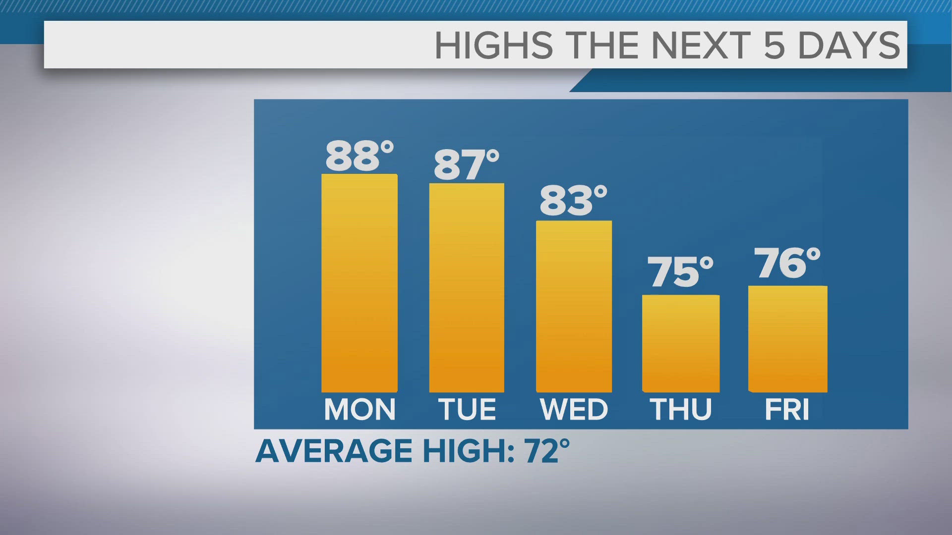
CLEVELAND — Memorial Day might be that typical mark for the "Start of Summer", but we're start with some summer heat a week ahead of time. More mid to upper 80s for highs Monday and Tuesday. Passing clouds each day with a small chance for a stray shower/storm.
Wednesday will be a day to watch as a cold front moves our way. Highs will still be in the 80s with showers and storms developing. Some of those could be on the strong side. That front will put temperatures back into the 70s for the rest of the week. Next round of showers/storms will be arriving for Saturday and Sunday.
THE 3 DAY FORECAST
MONDAY: Sun and clouds, Stray PM storms. Mid/Upper 80s.
TONIGHT: A few clouds. 60s
TUESDAY: Sun and clouds. Stray shower/storm possible. Mid/Upper 80s.
WEDNESDAY: Few clouds, scattered storms. Mid 80s
Here are some quick weather resources you can use:
---------------------------------------------------------------------------------------------------
Get more weather from the 3News Weather team of Betsy Kling (@betsykling), Matt Wintz (@WintzWeather), Anthony Copeland (@WeatherManAC) and Hollie Strano (@holliesmiles)
►MORE WEATHER | Get the latest weather headlines, video, photos & more
►ENVIRONMENT NEWS | Find out more about the world around us
►EARTH & SPACE NEWS | Learn more about our planet and outer space
►WEATHER FEATURES | Read our weather guides, storm reports & more
MORE WEATHER-RELATED HEADLINES: