
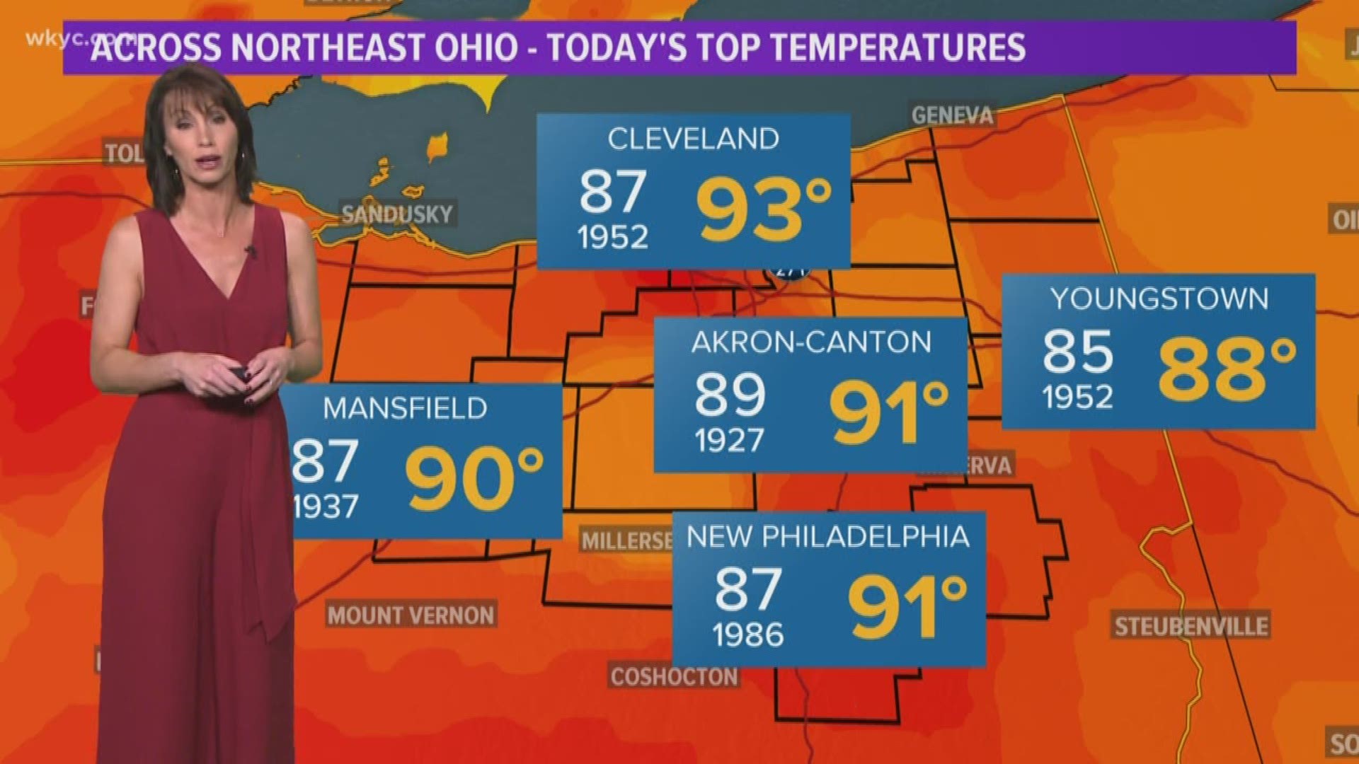
CLEVELAND — At Cleveland Hopkins International Airport, the high reached 93 degrees at 3:02 p.m. this afternoon to shatter the old record of 87 degrees set way back in 1952.
The high heat was being caused by a large upper level ridge of high pressure centered over the area. A frontal boundary north of Lake Erie will settle south as a cold front overnight, then stall over the area through Thursday before finally being pushed east.
Tuesday also marked the 20th day in 2019 when high temperatures hit 90 degrees or better in Cleveland. The highest temperature reached this year at Hopkins was 94 degrees on both July 19th and September 11th.
Several other records fell across northern Ohio Tuesday afternoon:
*Akron/Canton: 91 degrees (old record 89 degrees in 1927)
*Mansfield: 90 degrees (old record 87 degrees in 1927 & 1937)
*Toledo: 91 degrees (old record 80 degrees in 1897)
*Youngstown: 88 degrees (old record 85 degrees in 1952)
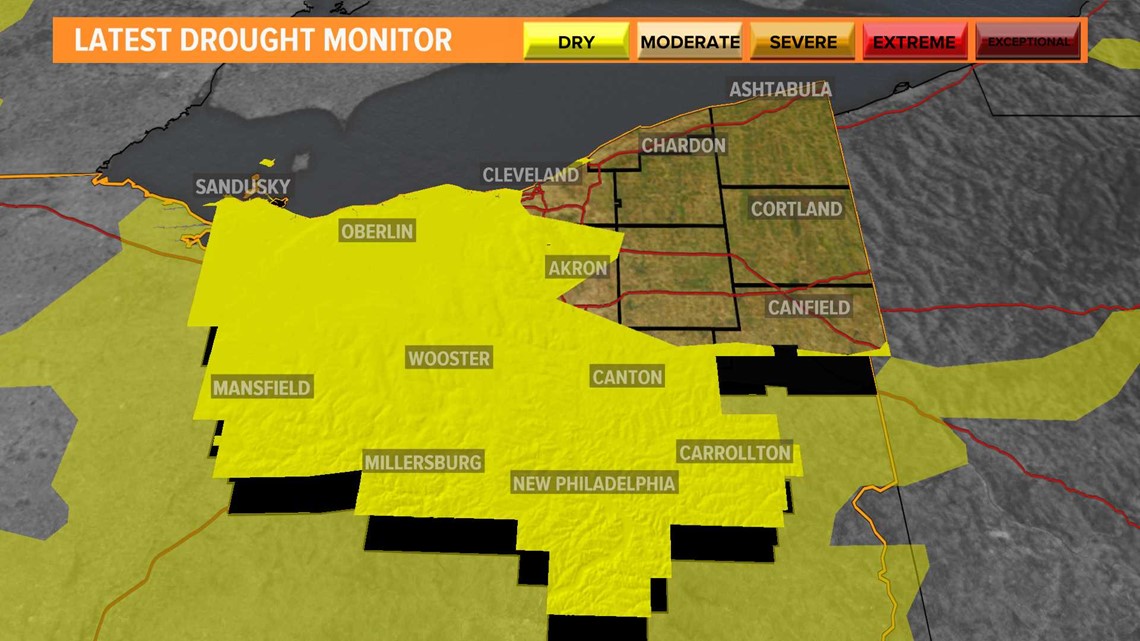
Tuesday's highs come on the heels of a record setting September for northern Ohio as the area saw the 2nd warmest September on record after September 1881 by just one degree.
September temperatures ended 6.3 degrees warmer than normal this year with precipitation amounts of only 1.28 inches of rain, or 2.53 inches less than we normally see.
Many areas from Cleveland westward and south are now seeing abnormally dry conditions according to the latest U.S. Drought Monitor as of Tuesday.

More seasonal autumn temperatures are on the way by Friday and into the weekend. Check out our latest forecast: /10-day