CLEVELAND — Snow is moving out of Northeast Ohio, but conditions are still very slippery on untreated surfaces throughout the region.
- FORECAST: See the extended weather outlook for Northeast Ohio
- iALERT: Closings and delays
Top of mind, however, is the flooding potential throughout the region due to all the snow melt and rainfall.
We're following the storm minute-by-minute with time-stamped updates below. Be sure to refresh this page frequently as it will be updated often as the storm evolves. You'll find the most-recent information at the top of the list.
FRIDAY
12:50 p.m. Power has been restored to more FirstEnergy customers. Cuyahoga County is reporting 660 outages, which is down from 1,637 as of 10:09 a.m. The number of outages in Lake County has dipped to 383.
11:57 a.m. ODOT shares this update from the roads:
10:09 a.m. The number of power outages continues to decline. Cuyahoga County now has 1,637 outages, which is down from 2,136 at 7:50 a.m. Portage County currently has 639 outages with Lake County at 400.
10 a.m. The Winter Storm Warning and Winter Weather Advisory issued for multiple counties have now expired. The only county under a Winter Storm Warning at this point is Ashtabula County until 1 p.m.
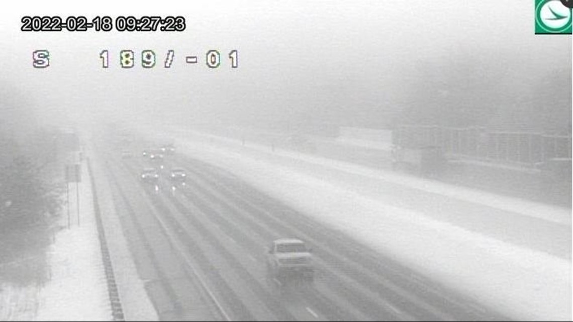
9:27 a.m. Here's a peek at the road conditions along I-77 at Hillside Road:

9 a.m. Heads up! These roads are closed in Stark County due to high water:
8:26 a.m. Heads up for those of you in Stark County!
7:58 a.m. The Summit County Sheriff's Office has activated a Level 1 Snow Emergency:
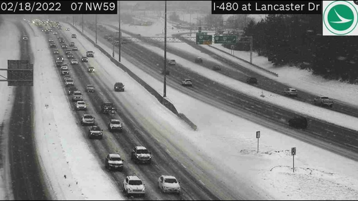
7:54 a.m. Snowy road conditions along I-480 at Lancaster Drive:

7:50 a.m. There are currently 2,136 customers without power in Cuyahoga County.
7:34 a.m. The snow is still coming down in spots...
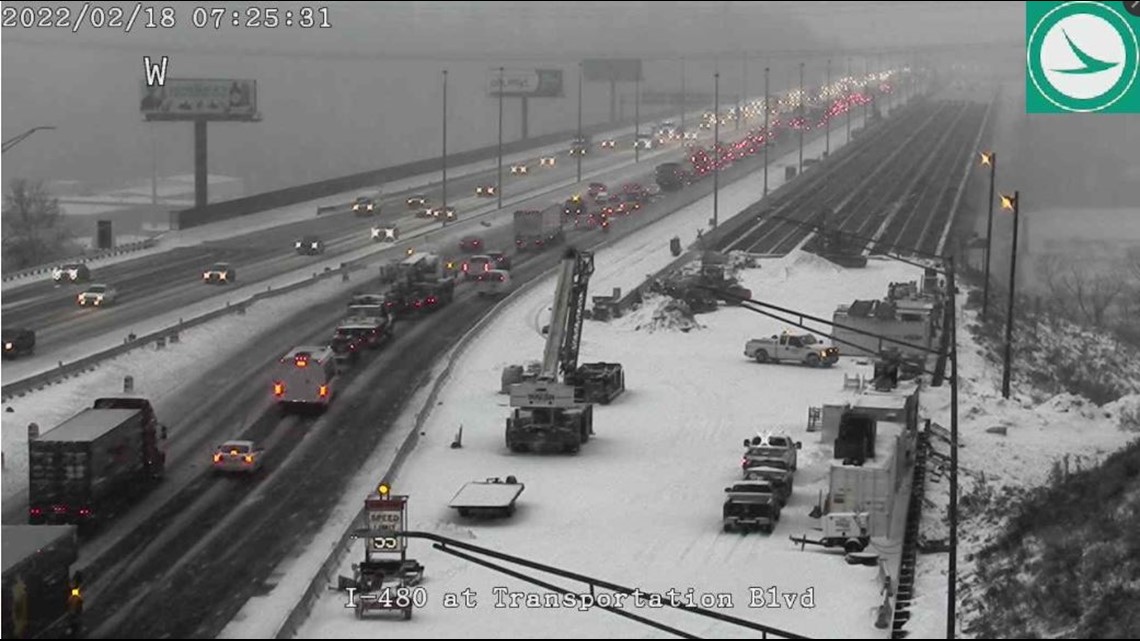
7:25 a.m. Here's a look at road conditions along I-480 at Transportation Boulevard:

6:45 a.m. 3News' Hollie Strano has another updated look at the weather forecast:
6:43 a.m. Winter Storm Warnings and Advisories have now been extended until 10 a.m. They were originally set to expire at 7 a.m.
RELATED: Winter Storm Warnings and Advisories extended as snow continues in several Northeast Ohio counties
6:25 a.m. Snow is still falling throughout Northeast Ohio:

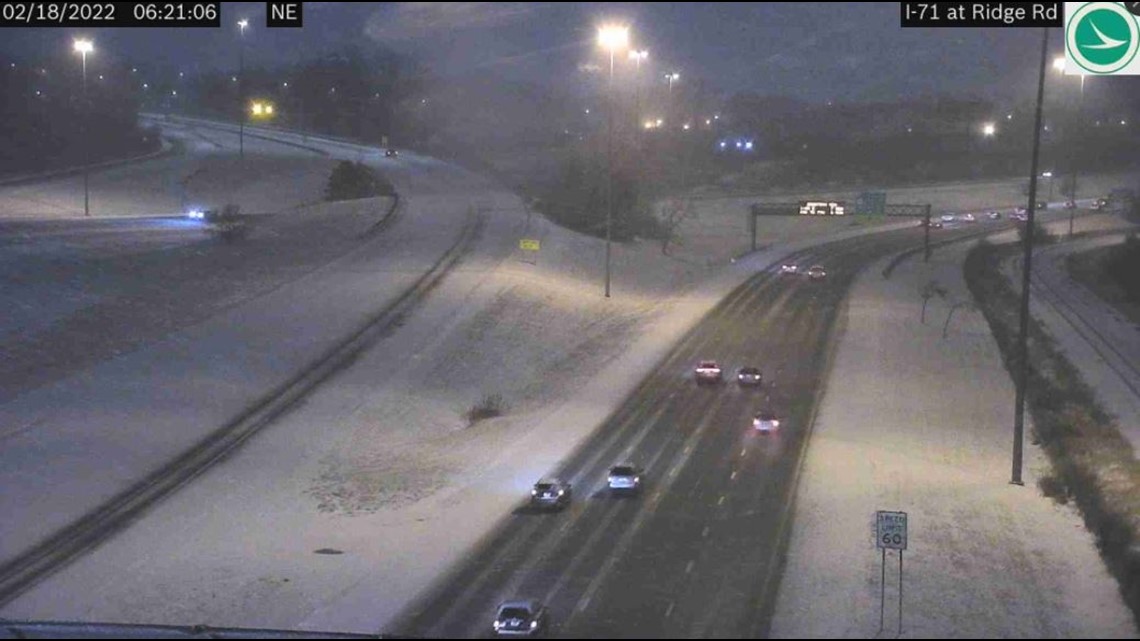
6:21 a.m. A look at road conditions along I-71 at Ridge Road:

We also have this traffic alert in Macedonia:
6:13 a.m. Heads up! There are multiple road closures due to flooding:
6:11 a.m. We're tracking multiple crashes this morning:
6:10 a.m. Updated power outage numbers:
- Cuyahoga: 2,292
- Geauga: 325
- Portage: 644
5:19 a.m. "Untreated surfaces remain icy," the National Weather Service warns as they give this update:
5:15 a.m. 3News' Hollie Strano gives an updated look at the weather forecast:
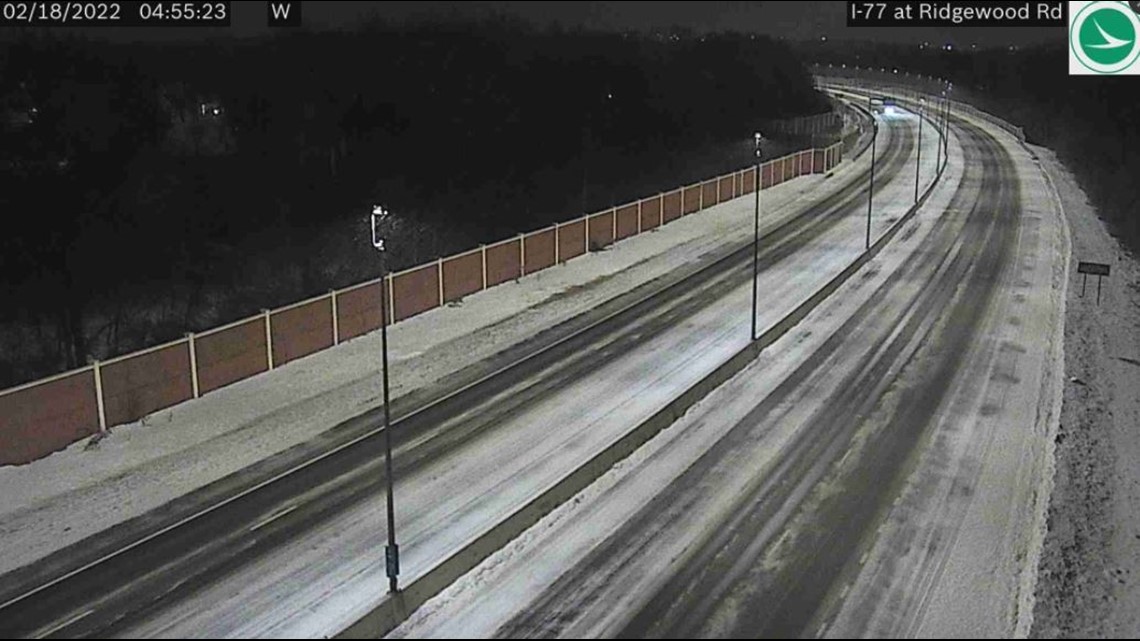
4:55 a.m. A peek at conditions along I-77 at Ridgewood Road:

4:45 a.m. Reminder... Here's a look at the counties currently under a Winter Storm Warning until 7 a.m. today:
- Cuyahoga
- Geauga
- Lake
- Lorain
Those under a Winter Weather Advisory until 7 a.m. include:
- Medina
- Portage
- Summit
- Trumbull
ODOT also shares this update from the roads:
4:30 a.m. Here's an updated look at power outages throughout Northeast Ohio:
- Cuyahoga: 3,575
- Geauga: 738
- Portage: 640
12:30 a.m. FirstEnergy is now reporting more than 11,000 power outages across its Northern Ohio service area. Here are some of the local counties that have been impacted the most:
- Ashtabula - 2,685 outages
- Cuyahoga - 2,726 outages
- Geauga - 1,413 outages
THURSDAY
11:45 p.m. Let's check in with our Chief Meteorologist Betsy Kling for the latest look at our weather conditions as "What's Next" gets underway.
Also, Carmen Blackwell checked in with some drivers around downtown Cleveland as the conditions worsen.
11:15 p.m. Power outage figures continue to rise across Northeast Ohio. Here are some of the latest county numbers from FirstEnergy:
- Medina - 2,274 outages
- Cuyahoga - 772 outages
10:30 p.m. Here's the latest from the Ohio Department of Transportation (ODOT) as they look to keep the roads clear.
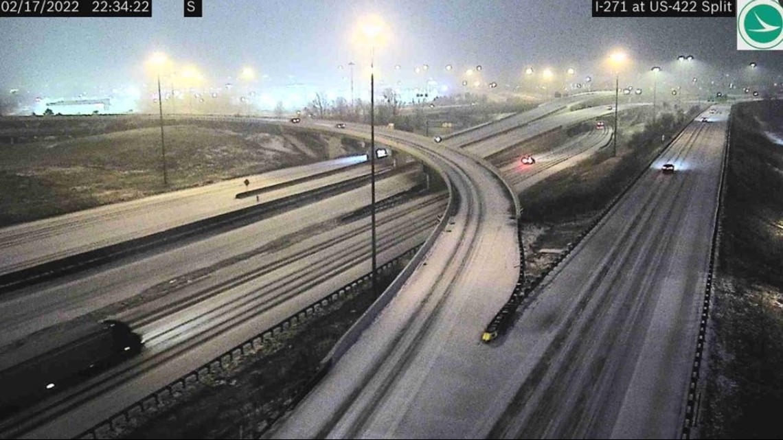
ODOT's OHGO cameras have also provided us with a look at road conditions in the area. Here's how it looks at I-271 and U.S. 422 near Beachwood.

On the west side, here's I-90 at SR 83 in Avon:

10:15 p.m. Here's a list of those areas under a Flood Warning from the National Weather Service
Flood Warnings for parts or all of Summit, Stark, Mahoning, Holmes, Portage and Wayne counties will be in place until 5:00 a.m. Friday.
10:00 p.m. We are starting to see more power outages being reported by FirstEnergy across Northeast Ohio. There are more than 4,500 customers without power overall, with Medina County reporting the most outages with 1821.
9:30 p.m. According to the Greater Cleveland Regional Transit Authority (RTA), all of its rail lines are experiencing major delays due to the ice buildup on the overhead catenary system. Buses are being made available to supplement the Red, Blue, and Green line rail service.
9:15 p.m. Here's the latest from the Ohio Department of Transportation:
8:52 p.m. We are starting to see some flight delays and cancellations at Cleveland Hopkins International Airport due to the weather conditions. Check with your airline before you leave for the airport.
8:45 p.m. In Portage County, State Route 44 between U.S. 224 and SR 619 is closed due to high water. Motorists are advised to avoid this area.
8:40 p.m. School districts are starting to announce closures for Friday. One of the first to report was the North Ridgeville School District. Elyria City Schools will also be closed.
Remember, you can track school closings across Northeast Ohio with our iAlert system. Click here for more.
8:35 p.m. 3News Meteorologist Payton Domschke has a look at how the water levels are shaping up in several Northeast Ohio reivers.
8:30 p.m. The Chardon Fire Department has posted that Clark Road is closed east of Ravenna Road due to wires down. "Roads are becoming very icy in Northern Geauga Co. Don't travel unless you absolutely must," the department wrote on Twitter.
7:55 p.m. And it's official: The Al Roker Tower here at WKYC Studios is red! It indicates a Winter Storm Warning is in effect for Greater Cleveland.
7:50 p.m. The ice is moving through Cuyahoga County. In Westlake, the ODOT camera at I-90 and Columbia Road is iced over.
7:40 p.m. The Erie County Sheriff's Office has issued a Level 1 Winter Weather Road Condition Advisory. Roadways in the county are becoming icy. Huron, Ottawa, and Sandusky counties are also under a Level 1 advisory.
As a reminder, here is the breakdown of what each emergency level indicates:
Level 1 - Roadways are hazardous due to accumulated snow or ice. Drive cautiously.
Level 2 - Roadways are hazardous due to blowing and drifting snow and/or ice cover. Only those who believe it is necessary to drive should be on the roadways. Contact your employer to determine if you should report to work.
Level 3 - Roadways are closed to all non-emergency travel due to extremely hazardous conditions. No one should be on the roadway unless it is absolutely essential to travel. Those operating vehicles on the roadway for non-emergency reasons may be subject to arrest.
7:30 p.m. Betsy Kling reports that icing is now happening quickly across areas west of I-71 and along the lakeshore. Be careful out on the roadways.
7 p.m. We are starting to see ice forming in some areas, including in Lorain County.
6:30 p.m. Here's a look at our latest weather conditions and the forecast for tonight and into this weekend from our Chief Meteorologist Betsy Kling.
6:04 p.m. The National Weather Service has also issued a Flood Warning for portions of Ashland County and Richland County until 3 a.m. on Friday.
The NWS says small stream flooding caused by rain and snowmelt is expected. Flooding of rivers, creeks, streams, and other low-lying and flood-prone locations is imminent or occurring.
As of 6 p.m., 1 to 1.5 inches of rain had fallen in the affected areas. An automated river gauge on the Black Fork of the Mohican River near Loudonville has risen to flood levels. Additional rainfall amounts of 0.5 to 1 inch are possible in the warned area.
Some locations that will experience flooding include: Loudonville, Bellville, Butler, Perrysville, Lucas and Mifflin.
5:55 p.m. The National Weather Service has issued a Winter Storm Warning for the following counties until 7 a.m. on Friday:
- Lorain
- Cuyahoga
- Lake
- Geauga
- Ashtabula
The National Weather Service is calling for moderate to heavy mixed precipitation in the affected areas, with total snow accumulations of 1 to 4 inches and ice accumulations of one tenth to a quarter of an inch. Winds may gust as high as 35 mph. Plan on slippery road conditions and poor visibility. The hazardous conditions could impact the morning commute.
Read more about the Winter Storm Warning here.
5 p.m. Betsy Kling has the latest updates on this developing weather system.
Meanwhile, Isabel Lawrence is giving us a look at the current road conditions.
And in Valley View, Emma Henderson breaks down flooding concerns along the Cuyahoga River and in other areas.
4:47 p.m. Due to the rough weather conditions, Brandywine Ski Area in Northfield will not be open Thursday. The resort has not yet made an announcement on Friday's hours.
4:06 p.m. If you've had it with this weather, maybe take 3News' Isabel Lawrence's advice and channel yourself to a sunnier place!
12:35 p.m. 3News' Emma Henderson gives an update from Vermilion:
11:54 a.m. Flood Warning issued in Erie County:
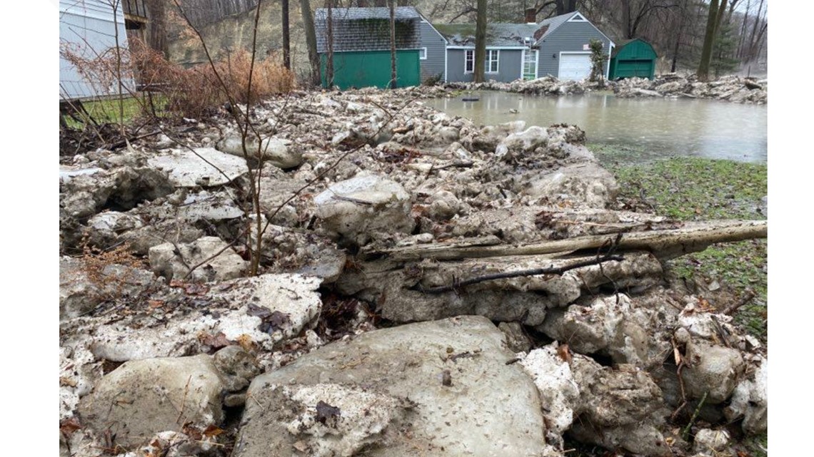
11:36 a.m. The National Weather Service says public safety officials "are watching the ice jam break and ice being flushed out of the Vermilion River."
11:16 a.m. A 3News crew said the Cuyahoga River appears "a little high," but is flowing in Valley View:

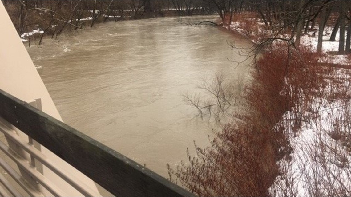
11:10 a.m. Flash Flood Warning activated in Vermilion along the river for "rapid rising water levels due to an ice jam break."
10:21 a.m. A 3News crew checking on conditions in Eastlake says "the river is open and flowing."
10:05 a.m. The National Weather Service in Cleveland shares a look at flooded road conditions from Chippewa Creek in Brecksville:
10 a.m. 3News' Matt Wintz shows how fast the temperatures will dive throughout the day:
9:57 a.m. 3News photographer Tim Coffey captured this image of the conditions in Willoughby Hills amid ongoing flooding concerns:

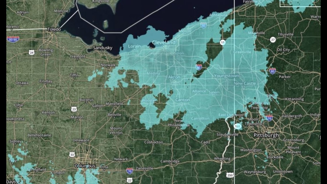
9:53 a.m. A new weather advisory has just been issued:
7:40 a.m. Ready for the rain?
5:30 a.m. Authorities say some Willoughby Hills residents put on alert to consider evacuation amid flooding concerns.
5:15 a.m. 3News' Hollie Strano says we can expect upwards of an inch of rain throughout the day.
“That is a lot of rain in a very short amount of time on top of snow melt,” she says.
Watch her update on the storm's timing: