
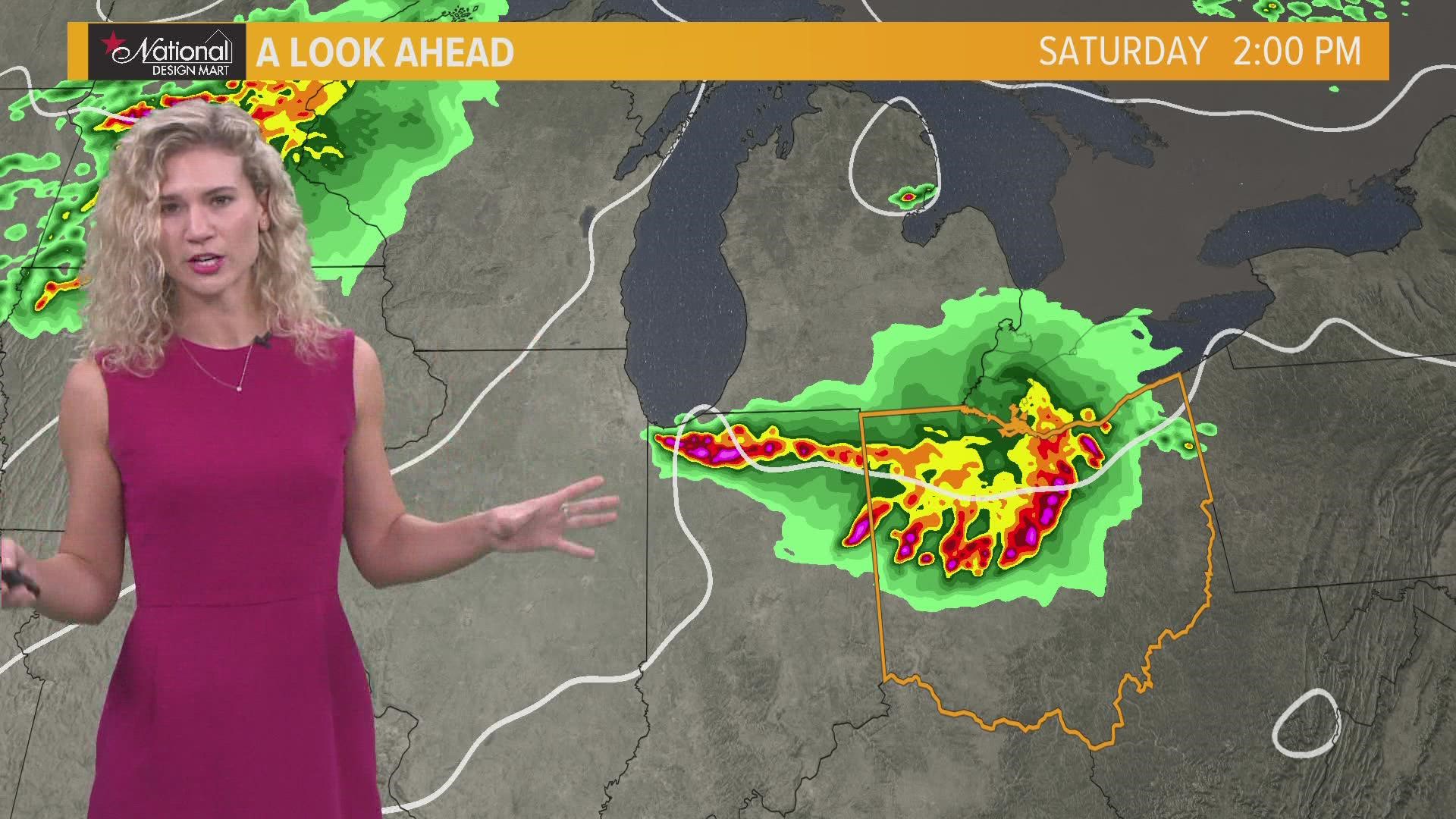
CLEVELAND — The National Weather Service has issued Severe Thunderstorm Watches for several counties in Northeast Ohio.
Severe Thunderstorm Warning: In effect until 2:45 p.m.
- Carroll County
At 2:05 p.m., a severe thunderstorm was located over Chester, or near East Liverpool, moving east at 30 mph. Wind gusts up to 60 mph, and quarter-size hail could be expected. Minor hail damage to vehicles is possible. Wind may possibly damage trees and power lines, resulting in some power outages.
Severe Thunderstorm Warning: In effect until 3:15 p.m.
- Columbiana County
Severe Thunderstorm Watch: In effect until 6 p.m.
- Ashland County
- Carroll County
- Columbiana County
- Coshocton County
- Holmes County
- Mahoning County
- Stark County
- Tuscarawas County
- Wayne County
The wet weather is expected to continue throughout the rest of the weekend into the beginning of next week.
Here's your 3 Day Forecast:
TODAY: Sun with variable clouds with a rain and rumble chance. Low 90s.
TOMORROW: Scattered storms, some could be on the strong side. Near 90.
MONDAY: Lingering showers early then partial clearing. Upper 70s and low 80s.
Stick with 3News as we continue to update this list throughout the day.