Travel delays, road closures, tree damage and power outages will all be likely given the weight of the snow and amount of ice anticipated.
Drenching rain will fall closer to the coast, but significant ice accumulations are likely in the Shenandoah Valley. Residents from the Outer Banks to the Delmarva Peninsula should be alert for standing water on roadways, as well as flooding of low-lying and poor drainage areas.
Elsewhere, chilly air and snow showers will sweep back into the Upper Midwest, while showers dampen coastal areas of Washington state. Dry and tranquil conditions will extend from the southern Plains through much of the West.
SPECIAL WEATHER
No new information for this time period.
WEATHER HIGHLIGHTS
No new information for this time period.
DAILY EXTREMES
National High Wednesday 91 at Immokalee, FL
National Low Wednesday -8 at West Yellowstone, MT
-----
►LIVE LOCAL RADAR | Track the current weather conditions
►MORE WEATHER | Get the latest weather headlines, video, your photos & more
►ENVIRONMENT NEWS | Find out more about the world around us
►EARTH & SPACE NEWS | Learn more about our planet and outer space
►WEATHER GUIDES | Read our weather guides, storm reports & more
►CURRENT NATIONAL SATELLITE:

►CURRENT NATIONAL TEMPERATURES:

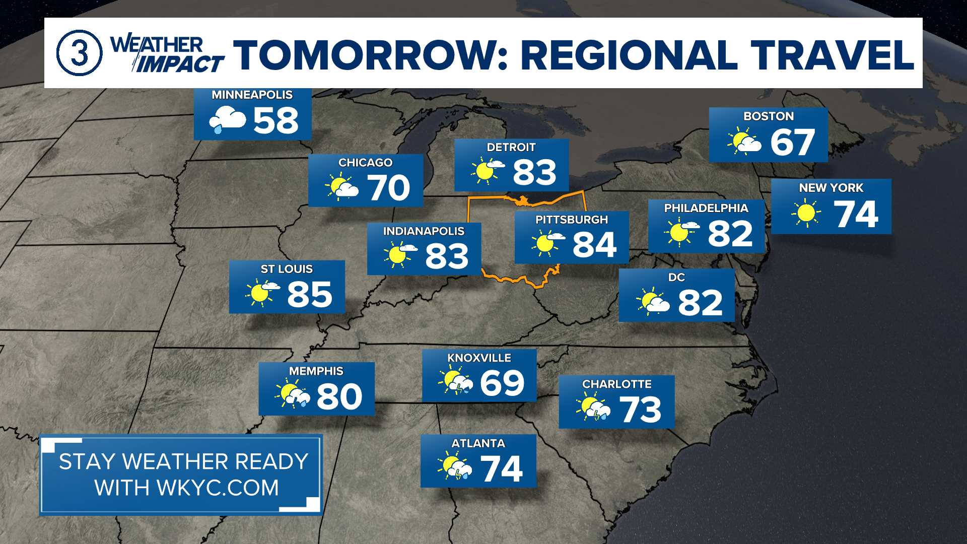
►YOUR TRAVEL FORECAST: