
Channel 3 Severe Weather Guide: What you need to know
What you need to know to be prepared for severe weather in Northeast Ohio.
Welcome to the WKYC Severe Weather Guide for the 2016 season prepared by the Channel 3 Weather Team of Chief Meteorologist Betsy Kling, Hollie Giangreco and Greg Dee.
In this guide, you will find plenty of useful tips, information and videos we have prepared especially for you to keep your family safe when severe weather threatens northeast Ohio.
When storms strike, tune to Channel 3 News throughout the day, watch our weather radar over-the-air on digital channel 3.3, log on to wkyc.com for the latest warnings and follow us on Twitter @wkycweather and on Facebook at facebook.com/WKYC.Channel3.Weather
KNOW THE SEVERE WEATHER TERMS:
- SEVERE THUNDERSTORM WATCH (Be Prepared): Severe thunderstorms are possible in and near the watch area. Stay informed and be ready to act if a severe thunderstorm warning is issued. The watch area is typically large, covering numerous counties or even states as is issued by the National Storms Prediction Center.
- SEVERE THUNDERSTORM WARNING (Take Action): Severe weather has been reported by spotters or indicated by radar. Warnings indicate imminent danger to life and property. Warnings typically encompass a much smaller area (around the size of a city or county) that may be impacted by an on-going severe thunderstorm. Warnings are issued by our local National Weather Service Forecast Office.
- TORNADO WATCH (Be Prepared): Tornadoes are possible in and near the watch area. Review and discuss your emergency plans and check supplies and your safe room. Be ready to act quickly if a warning is issued or you suspect a tornado is approaching. Acting early helps to save lives!
- TORNADO WARNING (Take Action): A tornado has been sighted or indicated by weather radar. There is imminent danger to life and property. Seek shelter immediately.
- FLOOD WATCH (Be Prepared): General flooding is possible in your area.
- FLOOD WARNING (Take Action): General flooding is already occurring or will occur soon in your area.
- FLASH FLOOD WATCH (Be Prepared): Flash flooding is possible in your area.
- FLASH FLOOD WARNING (Take Action): Flash flooding is already occurring or will occur soon in your area.
CRITERIA FOR A SEVERE THUNDERSTORM WARNING:
The National Weather Service will issue a severe thunderstorm warning based on ground spotter observations or via dual polarization radar when a storm has damaging straight-line winds of 58 mph or greater and/or hail 3/4 inch diameter or larger (golf ball size).
NOAA WEATHER RADIO SAVES LIVES:
NOAA Weather Radio broadcasts National Weather Service warnings, watches, forecasts and other hazard information 24 hours a day. Known as the "Voice of the National Weather Service," NOAA Weather Radio is provided as a public service by the Department of Commerce's National Oceanic and Atmospheric Administration.
The NOAA Weather Radio network has more than 425 stations in the 50 states and near adjacent coastal waters, Puerto Rico, the U.S. Virgin Islands and U.S. Pacific Territories.
For less than the cost of a new pair of shoes, you can own a special weather radio that provides instant access to the same weather reports and emergency information that meteorologists and emergency personnel use -information that can save your life!
These weather radios are available at many retail stores that sell electronics and on-line retailers. Ask for them by name.
DOPPLER RADAR LOOKS INTO THE EYE OF THE STORM:
Over the past several decades, Doppler radar has proved to be an invaluable tool to weather forecasters, allowing them to see inside storms to determine where precipitation — be it rain, snow, sleet or hail — is falling, as well as providing the ability to detect rotation in the atmosphere, thus providing important clues as to where tornadoes may be forming.
In fact, Doppler radars are so good at detecting what's in the atmosphere that they detect things that forecasters don't care to see, such as birds and mosquitoes.
Dual-polarization radar has the ability to far better determine the type and intensity of precipitation than its conventional Doppler radar counterpart, which leads to better estimates of rainfall amounts, which in turn can lead to more accurate flood and flash flood warnings.
The dual-pol upgrade includes new software and a hardware attachment to the radar dish that sends and receives both horizontal and vertical pulses of energy, providing a much more informative two-dimensional picture. Conventional Doppler radars only send out a horizontal pulse of energy that gives forecasters a one-dimensional picture of whatever is in the air, precipitation or non-precipitation.
It can see precipitation, but can't tell the difference between rain, snow, or hail. Dual-polarization radar helps forecasters clearly identify rain, hail, snow or ice pellets, and other flying objects, improving forecasts for all types of weather.
Another important benefit: dual-polarization more clearly detects airborne tornado debris — allowing forecasters to confirm a tornado is on the ground and causing damage so they can more confidently warn communities in its path. This is especially helpful in the dark when ground spotters are unable to see the tornado.
WHAT TO DO BEFORE A THUNDERSTORM OR TORNADO HITS:
- Develop a plan for you and your family at home, work, school and when you may be outdoors.
- Identify a safe place to take shelter should threatening weather approach your area.
- Have frequent drills of your weather preparedness plan.
- Know the county where you live or are visiting. The National Weather Service issues severe weather warnings on a county by county basis.
- Keep a highway map nearby to follow storm movement from weather bulletins when they are issued.
- Have a NOAA Weather radio with a warning alarm tone and battery back-up to receive warnings, and leave on, especially at night while you are sleeping.
- Listen to local radio and television stations for additional weather information.
- Check the weather forecast before going outdoors for extended periods of times.
- Keep an eye to the sky to watch for signs of approaching storms.
- If severe weather threatens, be prepared to check on people who are elderly, very young, or physically and or mentally disabled.
WHAT TO DO WHEN A THUNDERSTORM OR TORNADO APPROACHES:
- Remember: if you can hear thunder, you are close enough to a storm to be struck by lightning. Go to safe shelter immediately. Move to a sturdy building or car. Do not take shelter in small sheds, under isolated trees, or in a convertible automobile.
- If lightning is occurring and a sturdy shelter is not available, get inside a hardtop automobile and keep the windows up.
- Get out of boats and away from water.
- Telephone lines and metal pipes can conduct electricity. Unplug appliances not necessary to obtain weather information. Avoid using telephones or any electrical appliance. Use phones ONLY in an emergency.
- Do not take a bath or shower.
- Turn off air conditioner. Power surges from lightning can overload the compressors.
- Get to higher ground if flash floods are possible. Once flooding begins, abandon cars and climb to higher ground. Do not attempt to drive to safety. Note: Most flash flood deaths occur in automobiles.
WHAT TO DO IF CAUGHT OUTDOORS DURING SEVERE WEATHER:
- Find a low spot away from trees, fences and poles. Make sure the place you pick is not subject to flooding.
- If you are in the woods, take shelter under shorter trees.
- If you feel your skin tingle or your hair stand on end, squat low to the ground on the balls of your feet. Place your hands on your knees with your head between them. Make yourself the smallest target possible and minimize your contact to the ground.
- If you are boating or swimming, get to land and find shelter immediately.
WHAT TO DO AFTER THE STORM HAS PASSED:
- Remain calm and remain in a place of shelter until advised by emergency personnel that it is safe to leave.
- Promptly treat any injuries you or others suffered during the event.
- Call for medical assistance. Do not move seriously injured people unless they are in immediate danger of further injury.
- Do not light matches, burn candles, or turn on electrical switches if you suspect damage to your facility or place of residence. Any of these actions can ignite fires. Use a flashlight or battery-powered lantern.
- Do not touch downed power lines or objects in contact with downed power lines. Report electrical hazards to the police and the utility company.
- If you smell gas or suspect a leak, turn off the main gas valve, open all windows and leave the building immediately. Notify the police or fire departments. Do not do anything that could cause a spark.
WHEN "THUNDER ROARS, GO INDOORS":
- Stay off corded phones, computers & electrical equipment that put you in direct contact with electricity.
- Avoid plumbing including sinks, baths and faucets.
- Stay away from windows and doors, and stay off porches.
- Do not lie on concrete floors or lean again concrete walls.
- If stuck outdoors, immediately get off elevated areas like hills and stay away from trees, power lines, barbed wire fences, ponds, lakes or other bodies of water as they can all conduct electricity to the surrounding area if hit by a lightning bolt.
- If someone is struck, provide medical aid immediately. Remember victims DO NOT remain electrically charged after being hit by lightning. Administer CPR and AED, if necessary and get the victim to a medical facility as quickly as possible.
IF YOU ENCOUNTER HIGH WATER, "TURN AROUND, DON'T DROWN":
- Do not walk through moving water. Six inches of moving water can make you fall. If you have to walk in water, walk where the water is not moving. Use a stick to check the firmness of the ground in front of you.
- Do not drive into flooded areas. "Turn Around, Don't Drown." If flood waters rise around your car, abandon the car and move to higher ground if you can do so safely. You and the vehicle can be quickly swept away.
- Remember flood water may be contaminated by oil, gasoline, or raw sewage. Water may also be electrically charged from underground or downed power lines. Service damaged septic tanks, cesspools, pits, and leaching systems as soon as possible. Damaged sewage systems are serious health hazards.
- Be aware of areas where floodwaters have receded. Roads may have weakened and could collapse under the weight of a car.
- Listen for news reports to learn whether the community's water supply is safe to drink.
- Return home only when authorities indicate it is safe.
- Use extreme caution when entering buildings; there may be hidden damage, particularly in foundations.
- Clean and disinfect everything that got wet.
BECOME A SKYWAN SEVERE WEATHER SPOTTER AND HELP SAVE LIVES:
You can help the National Weather Service by becoming a SkyWarn Severe Weather Spotter. SkyWarn members are a dedicated group of volunteers who watch the conditions carefully in their area during periods of strong to severe weather.
These spotters then report their observations directly to the National Weather Service who then issue warnings as necessary to the general public. Most spotters are amateur radio groups or ham radio clubs, although that is not a requirement.
If you would like more information about our local northeast Ohio SkyWarn program or to volunteer to become a local storm spotter, visit http://weather.gov/cle/SKYWARN
SEVERE WEATHER FUN FACTS:
Straight Line Winds
- Straight line winds are responsible for most thunderstorm wind damage.
- Winds can exceed 100 m.p.h.!
- One type of straight-line wind, the downburst, is a small area of rapidly descending air beneath a thunderstorm.
- A downburst can cause damage equivalent to a strong tornado and can be extremely dangerous to aviation.
- A "dry microburst" is a downburst that occurs with little or no wind. These occur mainly in the western U.S.
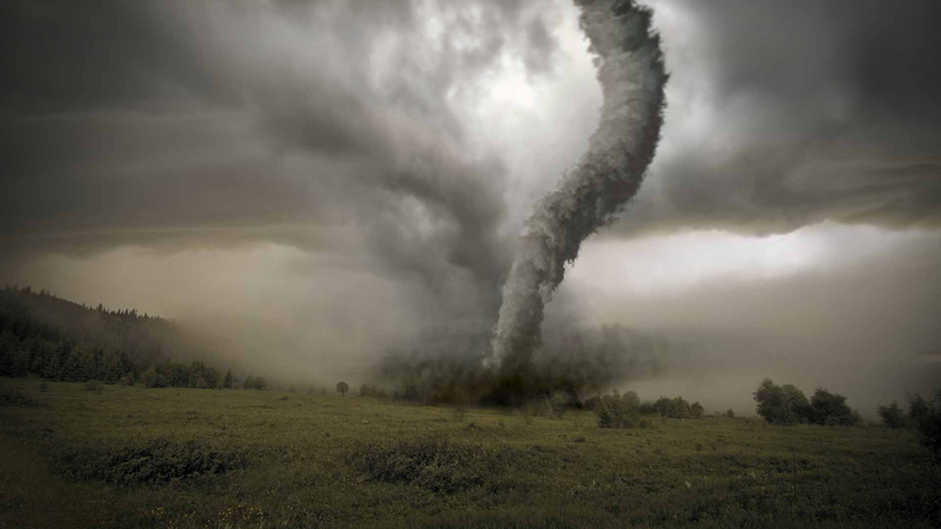
Tornadoes
- Twisters can occur any time of the year.
- The average forward speed is 30 m.p.h., but may vary from nearly stationary to 70 m.p.h.
- The strongest tornadoes have rotating winds of more than 250 m.p.h.
- Tornadoes are most likely to occur between 3 and 9 p.m., but can happen at any time.
Lightning
- Lightning causes an average of 80 fatalities and 300 injuries each year.
- Lightning occurs in all thunderstorms; each year lightning strikes the Earth 20 million times.
- The energy from one lightning flash could light a 100-watt light bulb for more than 3 months.
- Most lightning fatalities and injuries occur when people are caught outdoors in the summer during the afternoon and evening hours.
- Lightning can occur from cloud-to-cloud, within a cloud, cloud-to-ground, or cloud-to-air.
Hail
- Causes more than $1 billion in damage to property and crops each year.
- Large stones fall at speeds faster than 100 m.p.h.
- Strong rising currents of air within a storm, called updrafts, carry water droplets to a height where freezing occurs.
- Ice particles grow in size, becoming too heavy to be supported by the updraft, and fall to the ground.
Flash Floods/Floods
- Flash floods and floods are the #1 cause of deaths associated with thunderstorms...more than 140 fatalities each year.
- Most flash flood fatalities occur at night and most victims are people who become trapped in automobiles.
- Six inches of fast-moving water can knock you off your feet; a depth of two feet will cause most vehicles to float.
HOW CAN YOU BE "WEATHER READY":
WKYC has many ways for you to stay connected with us before, during and after the storm both on-air and on-line.
ON-AIR:
Channel 3 News is available on the following schedule every weekday:
- 4:00 a.m. - 7:00 a.m. Channel 3 News Today
- 11:00 a.m. - 12:00 p.m. - Live on Lakeside
- 6:00 p.m. - 6:30 p.m. - Channel News at 6
- 7:00 p.m. - 7:30 p.m. - Channel 3 News at 7
- 11:00 p.m. - 11:35 p.m. - Channel 3 News at 11
Channel 3 News is available on the following schedule every Saturday:
- 5:00 a.m. to 7:00 a.m. - Channel 3 News at Sunrise
- 9:00 a.m. to 10:00 a.m. - Channel 3 News Today Weekend
- 6:00 p.m. - 6:30 p.m. - Channel News at 6
- 11:00 p.m. - 11:30 p.m. - Channel 3 News at 11
Channel 3 News is available on the following schedule every Sunday:
- 6:00 a.m. to 8:00 a.m. - Channel 3 News at Sunrise
- 9:00 a.m. to 10:00 a.m. - Channel 3 News Today Weekend
- 6:00 p.m. - 6:30 p.m. - Channel News at 6
- 11:00 p.m. - 11:30 p.m. - Channel 3 News at 11
NEWS APP:
- Our WKYC News app is available in the iTunes and Google Play stores. Just text WKYC to 25543 on your mobile device for a direct link.
WEATHER APP:
- The WKYC Weather app is also available in the iTunes on Google Play stores with interactive radar, current conditions, the 10 day forecast and more. The app is particularly useful when the power goes out. Just text WKYC to 25543 on your mobile device for a direct link.
TWITTER:
- You can follow the Channel 3 Weather Team on our official weather Twitter account for regular storm updates found at @wkycweather
FACEBOOK:
- Our WKYC Weather Warriors page is also a great source for instant storm updates, storm photos, snow totals and more. Like us at facebook.com/WKYC.Channel3.Weather
Channel 3 will keep your #3Weather Ready throughout the severe season. Be sure to watch on-air and on-line for constant updates whenever severe weather threatens.