
CLEVELAND — It's been a beautiful Thursday!! Still pleasant this evening before clouds and rain potential return overnight. Patchy fog could be possible with temperatures in the low 60s. Showers and rumbles will be in the picture for much of Friday. Highs in the 70s and feeling rather muggy. A chance for stray showers will continue Friday night into early Saturday.
Improvement will be the name of the game for Saturday. Clouds in the morning and a damp start will give way to PM sunshine and a really nice afternoon. Sun and clouds Sunday with highs in the upper 70s to near 80 south. 80s for Monday and Tuesday with mainly dry conditions. Showers/storms return late Tuesday into Wednesday with breezy winds. Cooler for mid week with highs back in the mid 70s.


THE 3 DAY FORECAST
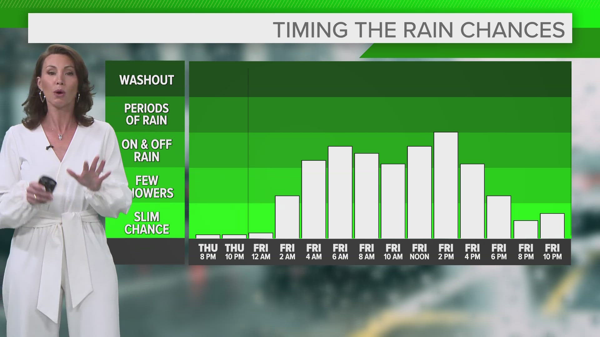
TONIGHT: Increasing clouds, rain chances after midnight. Chance for patchy fog. Low 60s.
FRIDAY: Scattered rain and rumbles. Low 70s.
SATURDAY: Lingering rain chance early then clearing skies. Mid to upper 70s.
SUNDAY: Sun and clouds with warm temperatures. Low 80s.
Here are some quick weather resources you can use:
---------------------------------------------------------------------------------------------------
Get more weather from the 3News Weather team of Betsy Kling (@betsykling), Matt Wintz (@WintzWeather), Anthony Copeland (@WeatherManAC) and Hollie Strano (@holliesmiles)
►MORE WEATHER | Get the latest weather headlines, video, photos & more
►ENVIRONMENT NEWS | Find out more about the world around us
►EARTH & SPACE NEWS | Learn more about our planet and outer space
►WEATHER FEATURES | Read our weather guides, storm reports & more
MORE WEATHER-RELATED HEADLINES: