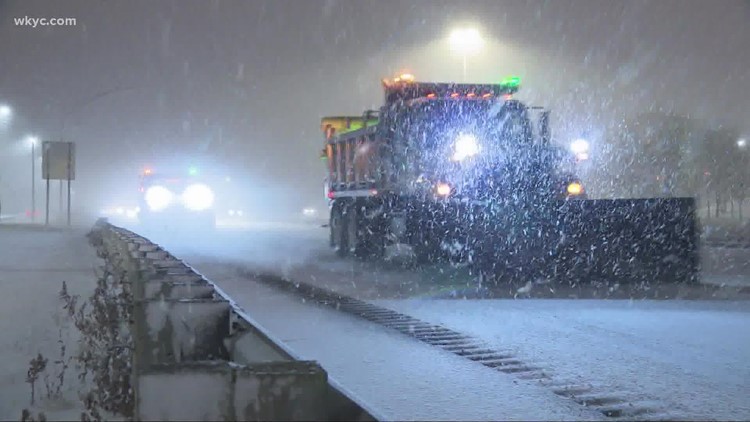
CLEVELAND — As we continue to track a significant winter storm for later this week, we're expecting major impacts across Northeast Ohio throughout the days ahead -- and it all arrives just before the Christmas holiday weekend.
How could this impact your travel plans? Below is a timeline of what you can expect from the winter storm… NOTE: This will be updated as new information about the storm comes in.
- LIST: iAlert school closings and delays
- INTERACTIVE RADAR: Track the storm
- YOUR AREA: Current weather alerts
- PICS & VIDEOS: Here's how to send us your weather photos / videos
- PARKING BANS IN EFFECT: See the list
- UPDATES: Download the free 3News app (Apple / Android) to follow the latest weather updates.
THURSDAY MORNING
We start the day in the 30s with cloudy conditions.
THURSDAY AFTERNOON / EVENING
Temps climb into the low 40s as rain chances move in by the afternoon and evening hours.
“Today we’re actually going to be in the 40s – and we actually hold that all the way up to midnight," explains 3News meteorologist Payton Domschke.
Watch an extended 10-minute forecast on the incoming winter storm:
FRIDAY MORNING
Temperatures will drop – fast – in the early morning hours.
"We see temperatures drop 30 to 40 degrees in a matter of hours," Domschke says. "That’s going to lead to a flash freeze.”
The transition from rain to snow will slide through Northeast Ohio with a strong punch.
“We’re going to go from near 40 on the east side to around the 20s at 1 a.m. on the west side," Domschke says.
By 8 a.m., all of Northeast Ohio will be experiencing dangerously cold temperatures with wind chills well below zero.
Wind gusts could top 50-60 mph at times, which could also result in power outages throughout the day. Wind chills will be well below zero with -30 conditions possible.
FRIDAY AFTERNOON / EVENING
The system continues with strong winds, dangerously cold wind chills and blowing snow. Power outages remain a concern.
SATURDAY (Christmas Eve)
Snow, wind and bitterly cold conditions continue. Highs around nine degrees.
SUNDAY (Christmas)
Flurries and breezy: Highs around 12 degrees. By the time we get to Sunday, we're looking at the potential of having 2"-5" of snow on the ground south of the Ohio Turnpike, with 6"-12" for those to the north.
“Closer to the lake you get, you will see more snow – especially through the primary snow belt as we wrap this system around through your holiday weekend," Domschke notes.