CLEVELAND — As strong storms have moved out of Northeast Ohio, below are real-time updates as the weather conditions evolved throughout the overnight hours...
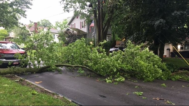
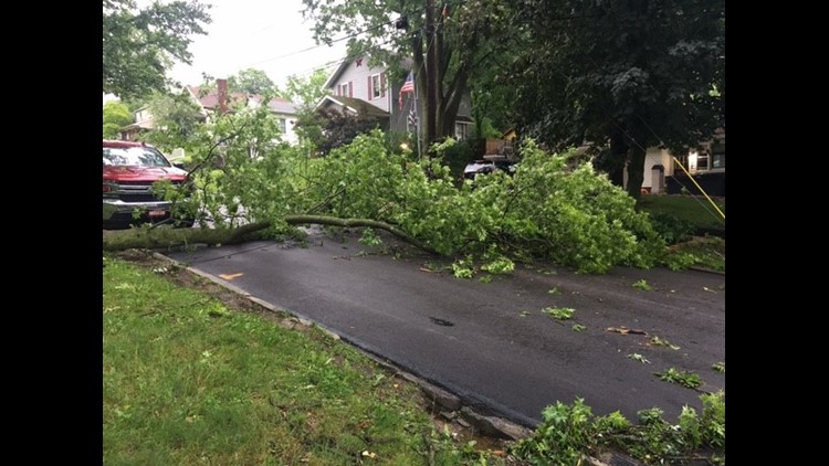
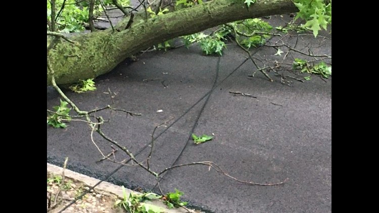
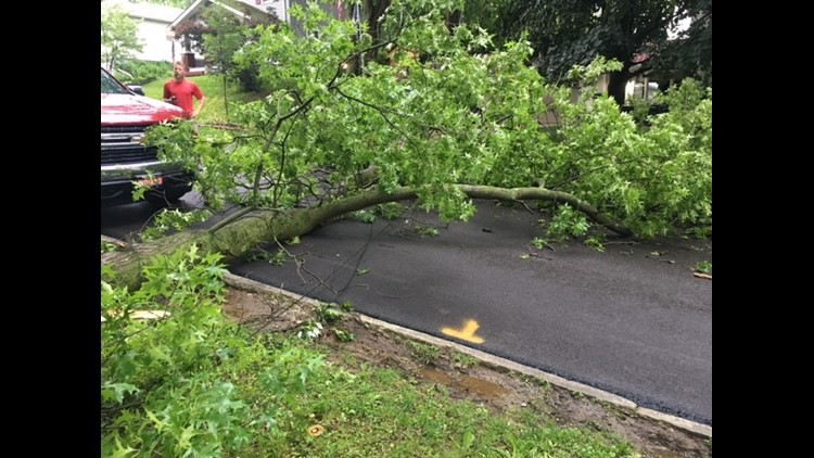
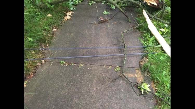
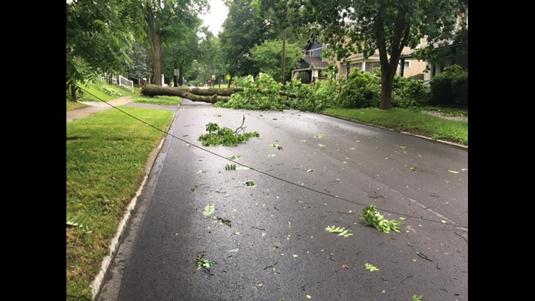
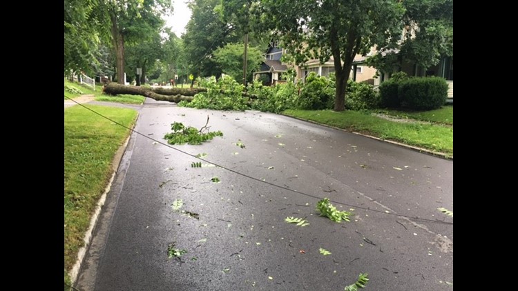
8:30 a.m. One of our crew members captured these photos of the storm's aftermath in Wooster:
PHOTOS | Storm damage in Wooster: June 14, 2022


6:45 a.m. Now that the severe weather threat is done, we now turn our focus to the dangerously hot conditions that will impact all of Northeast Ohio. 3News' Hollie Strano says the heat index could hit 111 degrees on Wednesday:
6:36 a.m. The Holmes County Sheriff says a Level 3 travel advisory remains in effect, which means roads are closed to non-emergency personnel.
6:32 a.m. 3News' Austin Love gives us a look at the storm damage in Wayne County:
5:41 a.m. A tweet from Mansfield shows storm damage after a tree fell on top of a house... Do you have any storm damage near you? Please send us your pictures by texting them to 216-344-3300 (make sure to include your name and location).
5:32 a.m. 3News' Austin Love gives an update from Wayne County:
5:35 a.m. The Wayne County Sheriff shares an update, announces a Level 2 travel advisory:
5:30 a.m. An update from the Wayne County Engineer's Office:
5:20 a.m. FirstEnergy is reporting thousands of power outages -- primarily in Richland and Ashland counties.
5:15 a.m. An updated look at the weather conditions with 3News' Betsy Kling and Hollie Strano:
4:45 a.m. 3News' Betsy Kling and Hollie Strano have team coverage with updates on the storms that moved through Northeast Ohio as extreme heat makes its way into the region next.
2:35 a.m. The Holmes County Sheriff's Office has issued a Level 3 storm travel advisory. This means that roads "are closed to travel by any means other than emergency vehicles at this time."
2:15 a.m. update: The Skyview Ranch in Millersburg says they are assessing damage and "will likely be without power for several days" as they clear fallen trees left behind by the storms.
They call damage to the camp as "substantial."
12:35 a.m. update: A Flash Flood Warning has been issued for Wayne, Stark, Holmes, Carrol and Tuscarawas counties. Please don't drive through flooded roadways and stay out of flood water.
12:30 a.m. update: The Wayne County Engineer's Office asks for everybody to avoid any unnecessary travel due to high water and downed trees / power lines.
<iframe src="https://www.facebook.com/plugins/post.php?href=https%3A%2F%2Fwww.facebook.com%2Fpermalink.php%3Fstory_fbid%3D5041722689280385%26id%3D350035365115831&width=500&show_text=true&height=480&appId" width="500" height="480" style="border:none;overflow:hidden" scrolling="no" frameborder="0" allowfullscreen="true" allow="autoplay; clipboard-write; encrypted-media; picture-in-picture; web-share"></iframe>
11:49 p.m. update: A tornado warning issued for Ashland, Holmes and Knox counties until 12:15 a.m.
11:45 p.m. update: Severe Thunderstorm Warning for Holmes, Medina, Stark, Summit and Wayne County in OH until 12:45am EDT. Alert sent from NWS
11:30 p.m. update: A Severe weather storm has been issued for Lorain, Medina, Ashland, Richland and Huron Counties until 12:00 a.m. as storms continue to make their way through the region.
The National Weather Service currently puts the entire region under a "hazardous weather outlook." What does that mean? Well, experts are predicting anything from thunderstorms to large hail to flash flooding, with other parts of the state even keeping an eye out for possible tornadoes.
3News chief meteorologist Betsy Kling believes the severe thunderstorm threat will be "widespread," but don't expect any twisters in our area. The biggest hit should come some time around midnight.
Betsy gave a live update of the situation earlier, and you can watch it again in the player below:
After the rain rolls though, then the heat comes in, as Northeast Ohio could be dealing with temperatures as high as 100 degrees at points throughout the ensuing week. As always, the WKYC Weather Team will be keeping you updated on conditions as they continue to develop.
If you have any photos of storm damage in your area, you can share then with us using the "Near Me" feature on the WKYC app or text photos and videos to 216-344-3300! Just remember to include your name, location and a description just in case we share the photo on TV.