
CLEVELAND — On Tuesday, parts of Northern Ohio were under a Tornado Warning as a severe storm moved its way through several counties. According to the National Weather Service (NWS), tornadoes did indeed touch down in Ohio.
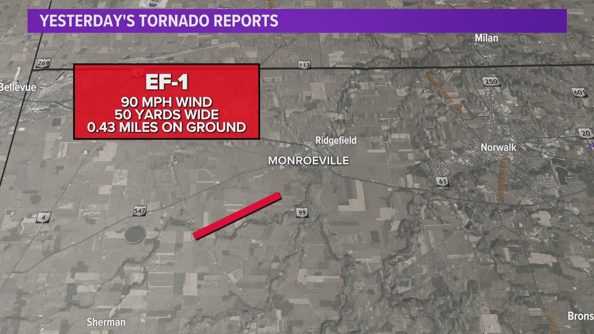
An NWS storm survey has confirmed an EF-1 tornado event occurred in Monroeville in Huron County at approximately 6:38 p.m. Winds reached around 90 miles per hour as the tornado touched down along Sand Hill Road blowing down 2 trees. In addition, the tornado picked up two grain bins and dropped the bins in a field 200 yards northeast of the fittings. The two bins were within a line of 6 bins. The survey adds that the tornado continued northeast across an open field and across Frink Run, blowing down a large pine tree before dissipating. 16 power lines were snapped along Sand Hill Road south of the tornado due to the rear flank downdraft.
An hour before the Huron County EF-1 tornado, an NWS storm survey confirmed that an EF-0 tornado event occurred in Hancock County from approximately 5:31 p.m. to 5:40 p.m. The tornado touched down a half-mile south of Rawson and lifted a quarter mile west of the Findlay Airport. The estimated peak wind of the EF-0 tornado was 80 miles per hour.
The survey reports that a barn metal roof was ripped off. Also, wood beams were snapped and driven into the ground. In addition, a residential barn was destroyed, several power poles were snapped and blown down, and several trees were blown down. There were no reports of any injuries.
In addition to Hancock and Huron counties, there were tornado warnings issued for Sandusky, Seneca, Erie, and Lorain counties as the storm headed eastward on Tuesday evening. There are no reports yet of any other confirmed touchdowns.
The Enhanced Fujita (EF) Scale classifies tornadoes into the following categories:
- EF0: Weak - 65 to 85 mph
- EF1: Weak - 86 to 110 mph
- EF2: Strong - 111 to 135 mph
- EF3: Strong - 136 to 165 mph
- EF4: Violent - 166 to 200 mph
- EF5: Violent - >200 mph
According to the 3News Weather Team, the storms have now moved out of Northeast Ohio, leaving behind cooler temperatures and foggy conditions. Temperatures will stay on the cool side on Wednesday with highs stuck in the low to mid 50s throughout the region. We'll also have cloudy skies. We climb into the low to mid 60s on Thursday and Friday before even warmer temperatures arrive early next week as we're watching for highs in the mid to upper 70s Monday and Tuesday.