
CLEVELAND — Accumulating snow has moved out of Northeast Ohio, and it left behind some traffic impacts throughout the region.
Below you will find minute-by-minute details of how the wintry weather evolved.
But first... Some important weather resources for you to check as we move through the wintry weather...
- LIST: iAlert school closings and delays
- INTERACTIVE RADAR: Track the snow
- CURRENT WEATHER ALERTS: See if your county is currently under a winter weather alert
- PICS & VIDEOS: Here's how to send us your weather photos / videos
- UPDATES: Download the free 3News app (Apple / Android) to follow the latest weather updates.
- SUBSCRIBE: Get the day's top headlines sent to your inbox each weekday morning with the free 3News to GO! newsletter
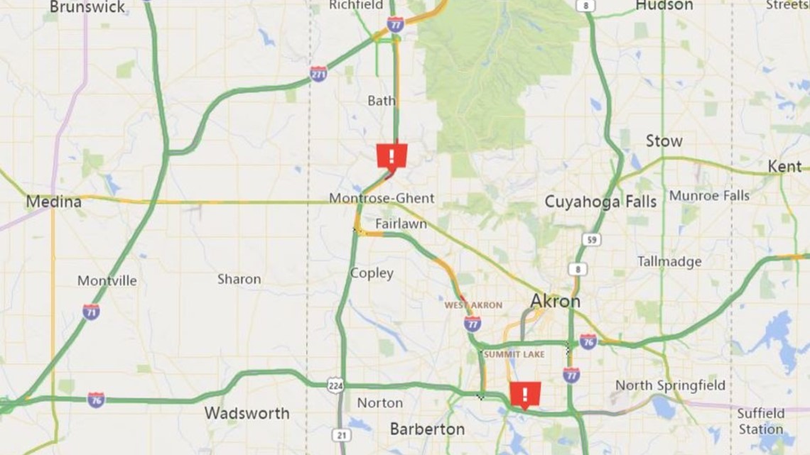
7:35 a.m. Drivers in Summit County are experiencing some traffic delays... ODOT says the right shoulder is blocked on I-77 North near Ghent Road due to a crash. There's also a crash on 224 East near Manchester Road where the left lane is blocked.

7 a.m. All of the winter weather alerts for Northeast Ohio have been canceled hours early after they were initially expected to expire at 10 a.m.
6:30 a.m. Has your neighborhood transformed into a winter wonderland? We want to see your snow pics!
6:24 a.m. We have a crash on I-90 West that could slow you down:
6:07 a.m. Heads up! A traffic update from Summit County:
6 a.m. Here's our latest team coverage:
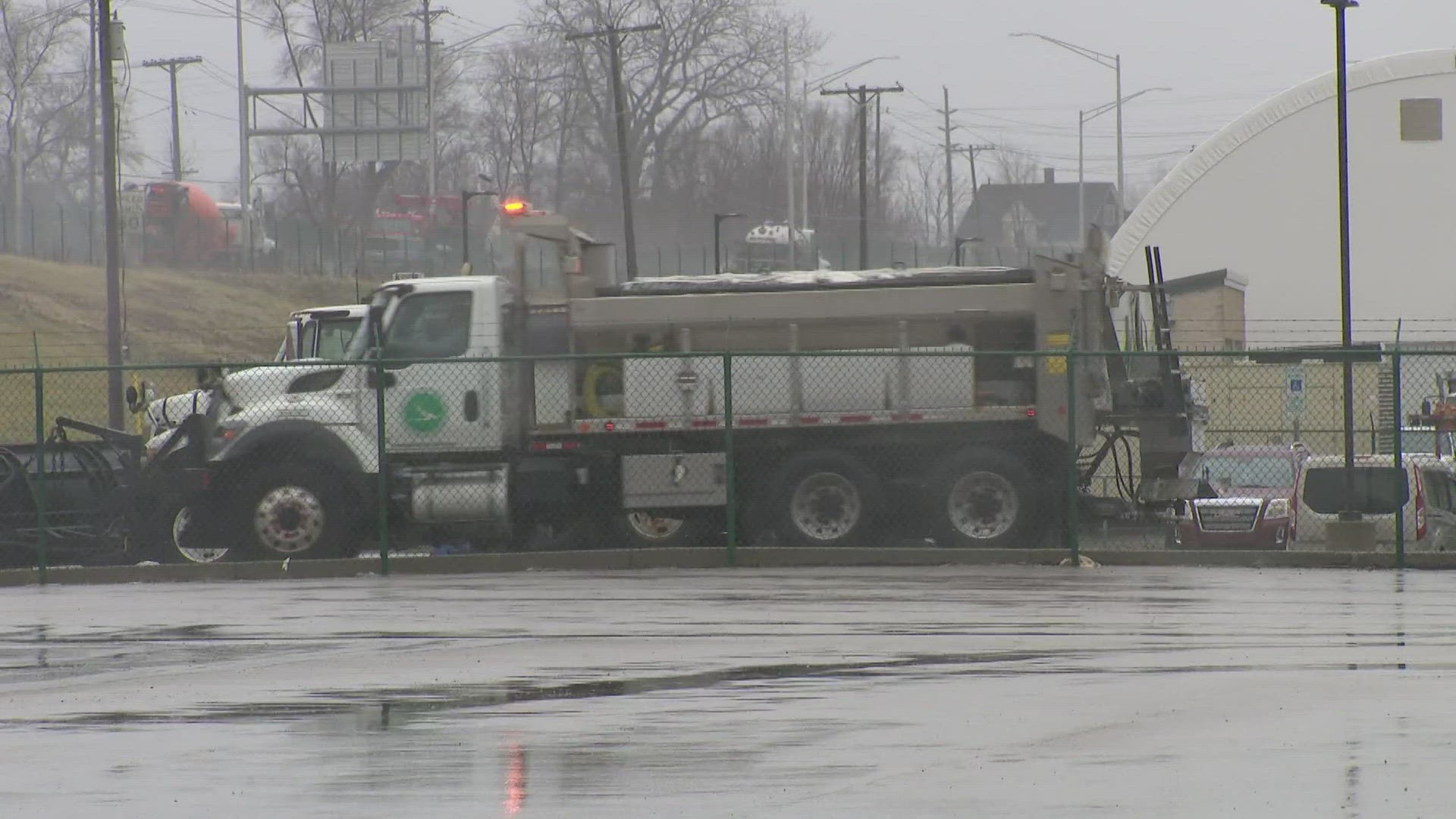
5:56 a.m. ODOT says there are nearly 700 crews currently working to clear the roads. This photo shares a view from I-480 in Cuyahoga County:
5:42 a.m. Here's a from Chagrin Falls:
5:35 a.m. Here's a live report on the conditions in Chagrin Falls from 3News' Kierra Cotton:
5:10 a.m. We only have a few iAlert school closings and delays. See the full list HERE.
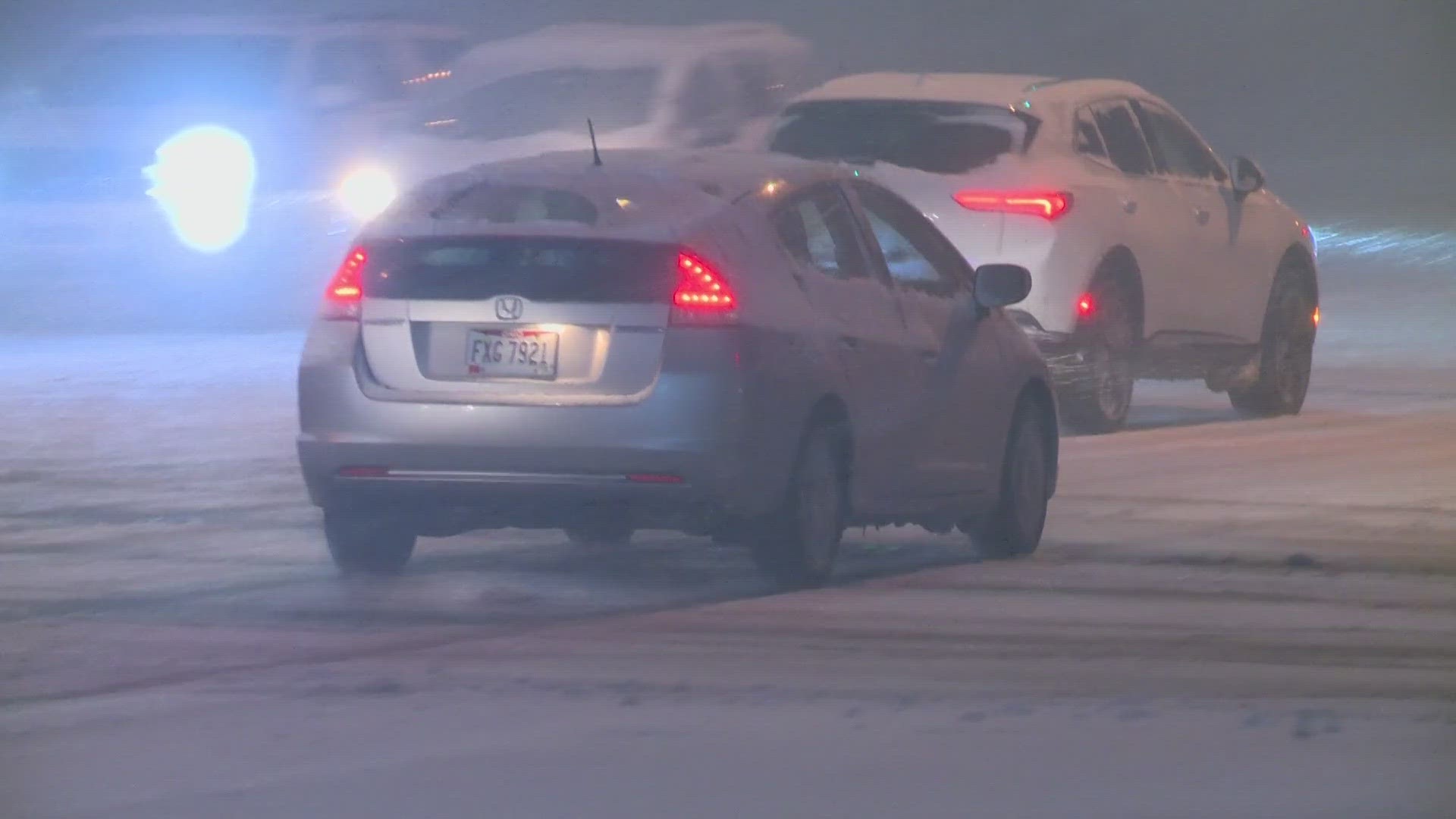
5 a.m. What are the roads like right now? Here's our team coverage with the latest weather and traffic impacts:
4:50 a.m. Tired of the snow? The National Weather Service says warmer temps are on the way later this week.
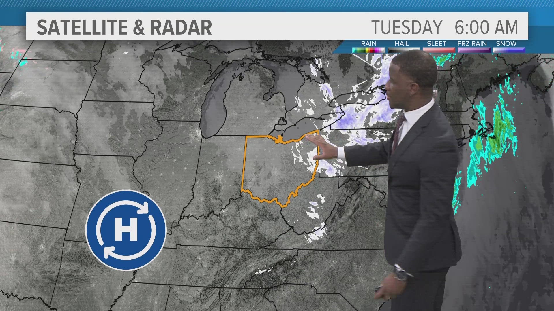
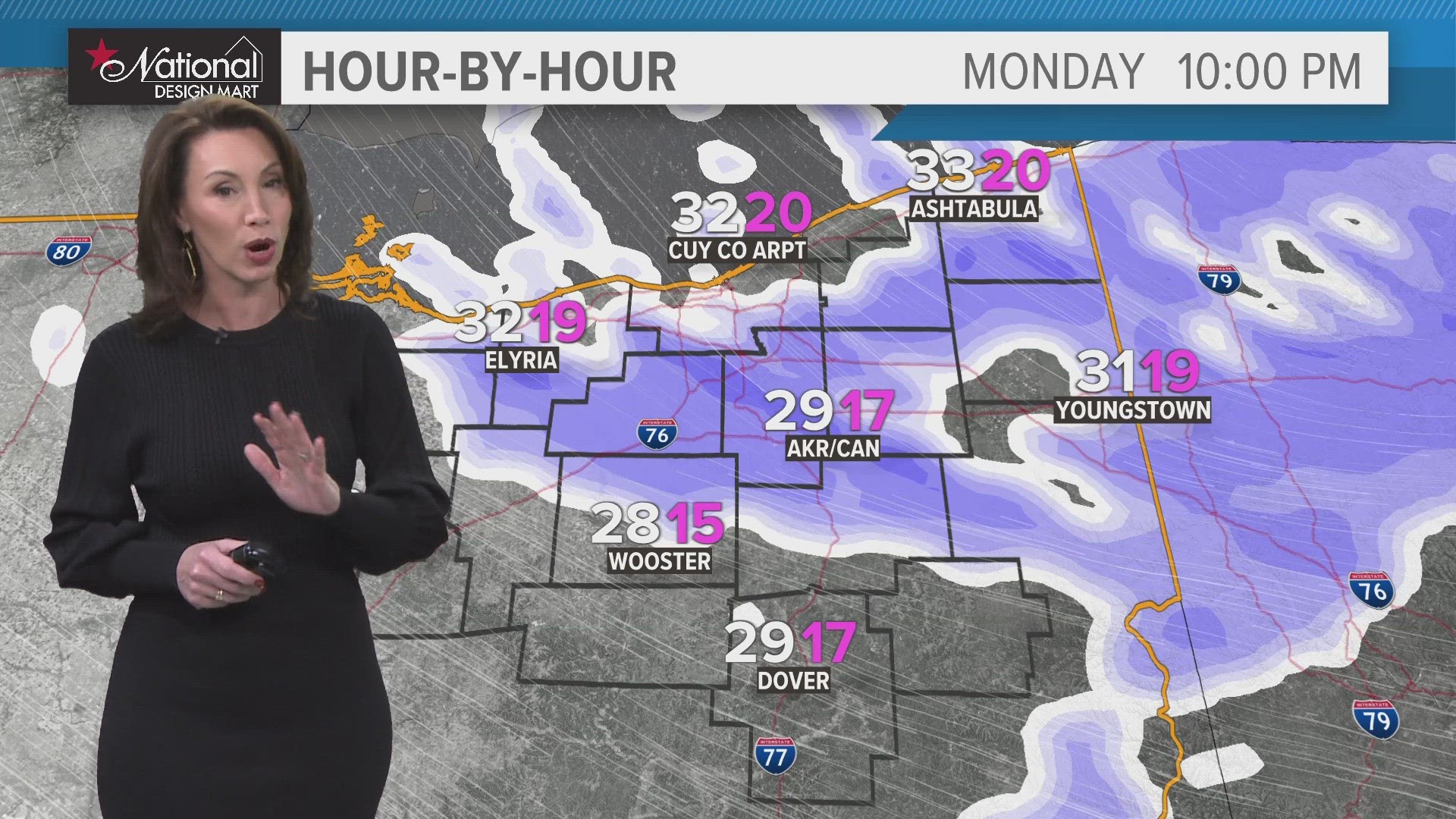
4:45 a.m. Here's a fresh look at your weather forecast as lake effect snow moves out:
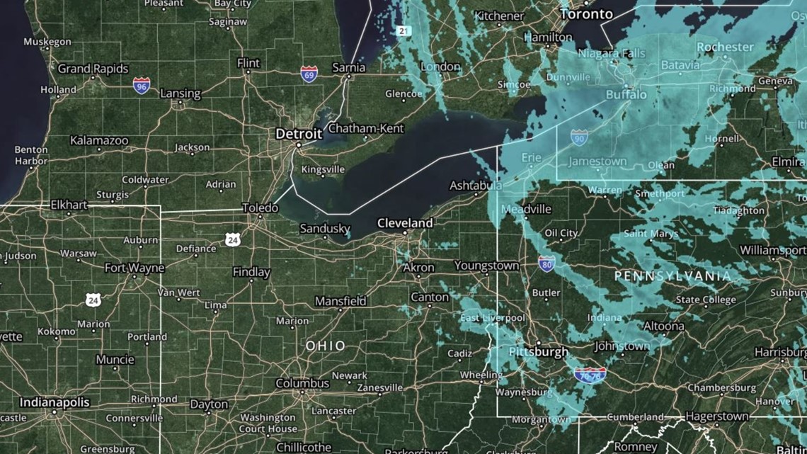
4:40 a.m. Our interactive radar shows the snow has mostly moved out of the region:

4:04 a.m. If you've been having issues accessing the OHGO traffic cameras, you're not alone...
3:35 a.m. An update from ODOT says there are nearly 700 crews working statewide:
MONDAY, DEC. 18
11:10 p.m. We have team coverage of the latest weather conditions, with Betsy Kling giving us an up-to-the-minute forecast and Lydia Esparra reporting from snowy Russell Township.
9:51 p.m. The city of Hudson says a portion of state Route 8 is currently closed.
9:02 p.m. Here's a quick peek on the roads in the Cleveland area:
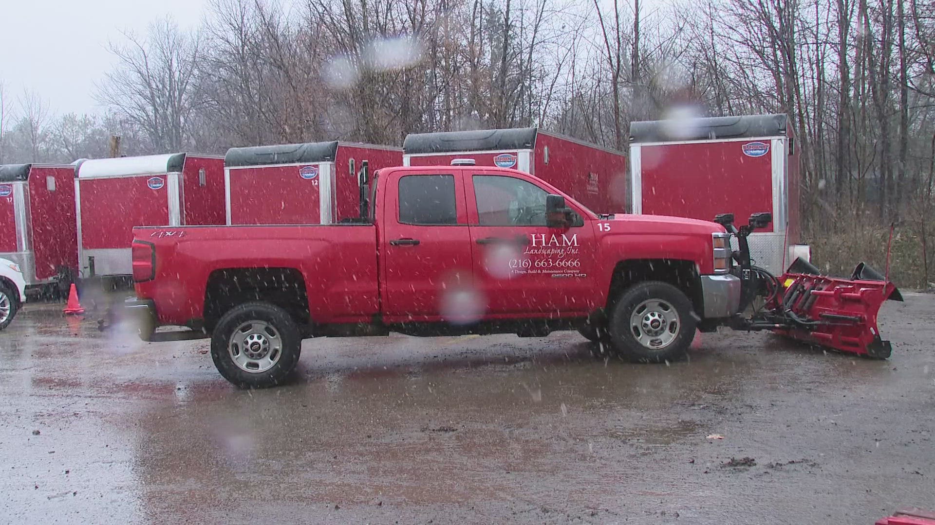
6:05 p.m. Kaitor Kay spoke with members of ODOT as well as area plow companies about their plans to tackle the roads.
H.A.M. Landscaping in North Randall will be salting and plowing residences and business on the east side of Cleveland — places like Beachwood, Shaker Heights, and Cleveland Heights. Owner Herrick Mann is a veteran at this, with more than four decades of experience and a crew of 30 people currently working 550 driveways and 100 parking lots.
"Everybody should expect that they're going to be texted, paged, called out somewhere between maybe 4 o'clock this afternoon to midnight tonight," Mann told us, "and that they should all be rested, sober, and ready to rock and roll and go."
6 p.m. Betsy Kling has the latest on the weather conditions.
5 p.m. Let's check in with 3News Chief Meteorologist Betsy Kling for a look at our weather conditions.
4:38 p.m. 3News Meteorologist Payton Domschke received this photo from Toni Schafer in Green showing some snow on the ground.
4:07 p.m. Speaking of ODOT, their press secretary, Matt Bruning, is providing updates on X about road conditions as the nasty weather gets underway. Here's the latest look at Geauga County:
4:05 p.m. Our Kaitor Kay spoke with officials from the Ohio Department of Transportation about preparations that were made before the nasty weather arrived.
4 p.m. Chief Meteorologist Betsy Kling kicks off 3News at 4 with a live look at our weather conditions across Northeast Ohio
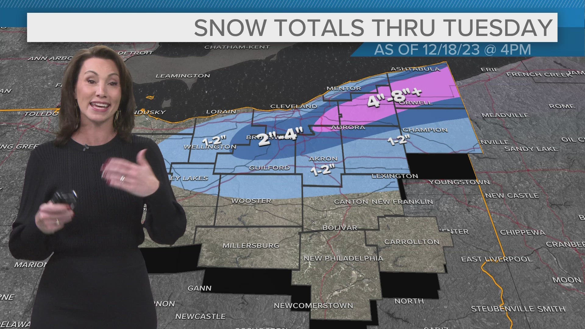
3:55 p.m. Here's the latest snow projections for Northeast Ohio from the National Weather Service:
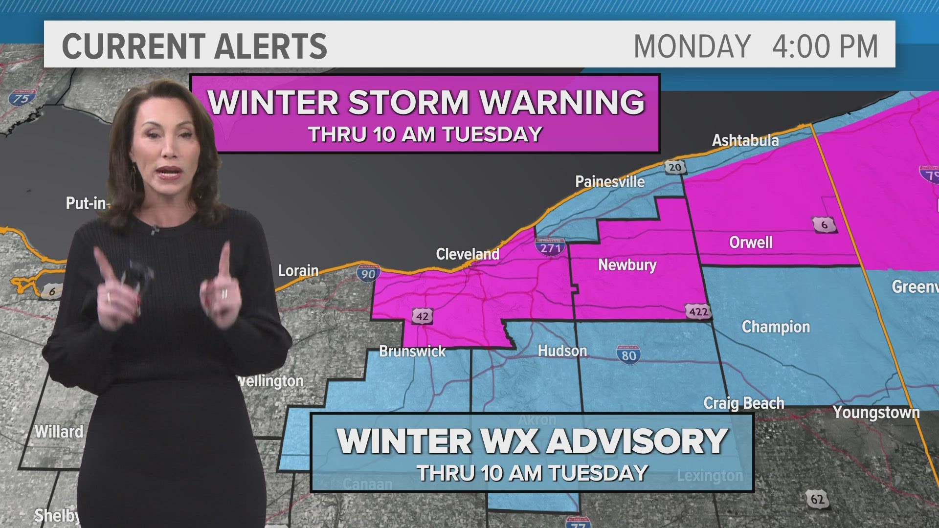
3:22 p.m. The National Weather Service has extended its Winter Storm Warning to Cuyahoga County from now until 10 a.m. Tuesday.
The NWS says heavy snow is expected with accumulations of 2 to 8 inches possible. Winds may be gusting as high as 40 mph. In addition, travel could be very difficult as areas of blowing snow could significantly reduce visibility. The hazardous conditions may impact this evening's commute as well as the morning commute tomorrow.
More from the NWS: "Snow will intensify during the evening commute today and be heavy at times through late tonight. The heaviest snow will fall away from the lakeshore in the higher elevations of eastern Cuyahoga County. Snow will diminish from west to east on Tuesday morning. Temperatures will fall into the 20s overnight with wind chills in the teens."
Geauga County and inland Ashtabula County are also under a Winter Storm Warning. Lakeshore Ashtabula, Lake, Medina, Portage, Summit, and Trumbull counties are under a Winter Weather Advisory.
11:50 a.m. An update from ODOT Cleveland: "It is possible heavy snow will impact the Monday evening commute."
11:29 a.m. ODOT says they have 365 crews working throughout the state:
11:20 a.m. Here's a wide view of our interactive radar...


8:30 a.m. 3News' meteorologist Anthony Copeland gives a quick update on the incoming snow...
6:26 a.m. Here are the winter weather alerts as issued by the National Weather Service:
5:15 a.m. Here's a look ahead at the incoming wintry weather and the expected impacts across Northeast Ohio...