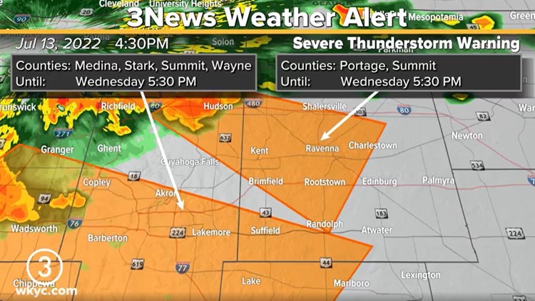
CLEVELAND — The National Weather Service has issued a Severe Thunderstorm Warning for several counties in Northeast Ohio on Wednesday afternoon:
- Southwestern Portage County
- Southeastern Medina County
- Western Stark County
- Southern and Northeastern Summit County
- Northeastern Wayne County
The warning is in effect until 5:30 p.m.
At 4:46 p.m., a severe thunderstorm was located near Chippewa Lake, or near Medina, moving southeast at 45 mph. One minute later, a severe thunderstorm was located over Hudson, or 12 miles north of Akron, moving southeast at 20 mph.
Wind gusts of 60 miles per hour are possible in the affected areas, along with damage to trees and power lines.
Once this wet weather moves out, we're looking nice and quiet as we approach the weekend.
“Overnight, we’re going to clear and make our way into a beautiful Thursday and Friday," 3News meteorologist Hollie Strano says.
Here's your 3 Day Forecast:
TODAY: Mix of sun and clouds early with chances for scattered showers and storms in the afternoon. Around 80.
THURSDAY: Sunny skies, comfortable. Upper 70s.
FRIDAY: More sunshine. Low 80s.
Do you want to be among the first to know the most important local and national news? Download the free WKYC app and get updates right on your phone: Android, Apple.
Related Stories: