
CLEVELAND — As today's temperatures approach record-breaking territory with highs into the 60s, we're also keeping a very close eye on big changes with the potential for severe weather across Northeast Ohio.
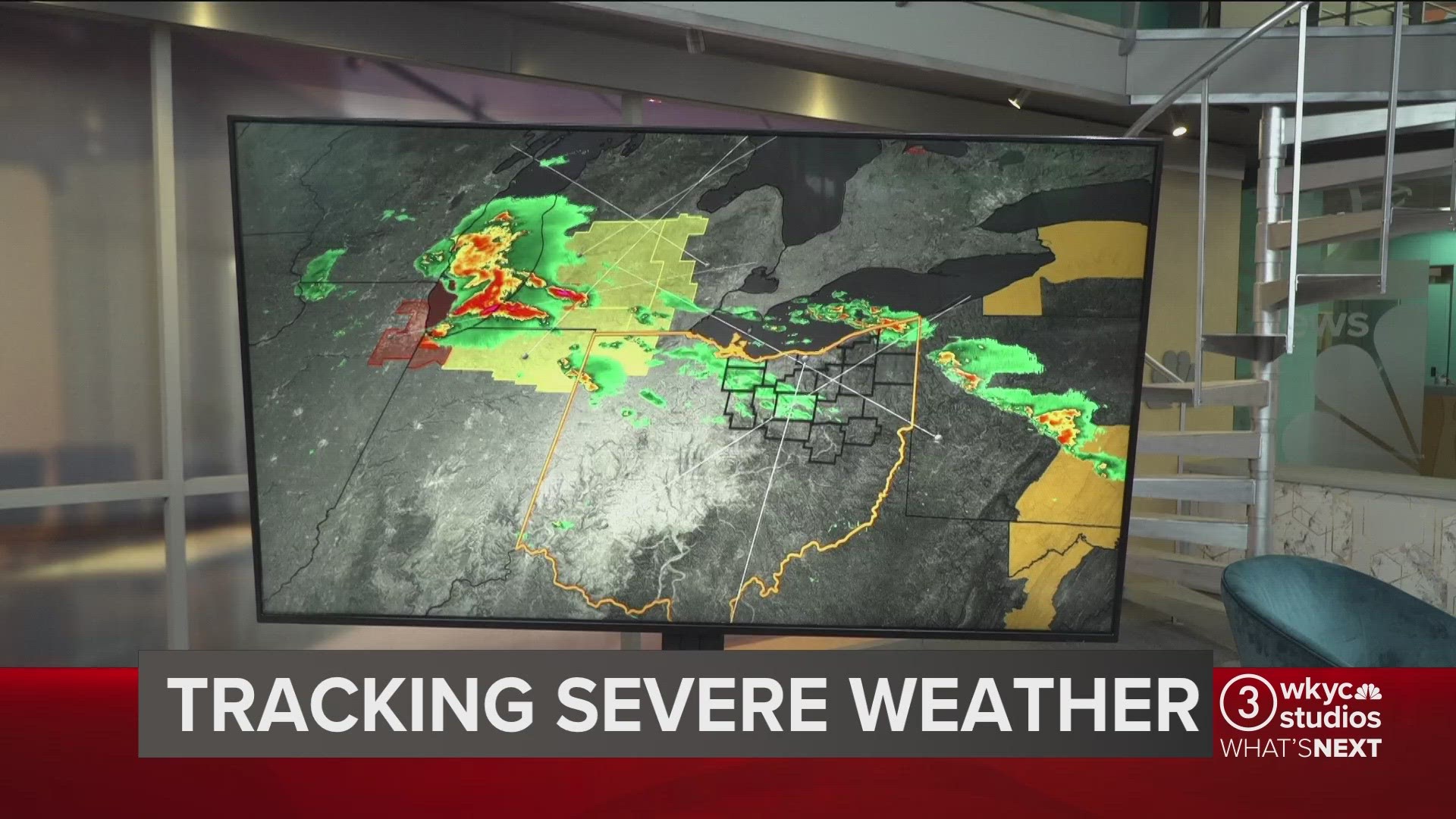
“In terms of threats, we’re not off the chart, but I do have damaging winds and large hail as the primary threat," explains 3News' Senior Meteorologist Matt Wintz. "We can’t rule out a tornado or two, there’s lots of sheer in the atmosphere tonight and tomorrow. Flooding would be brief, but we could get some heavy rain.”
Here's a timeline of what you can expect throughout the hours ahead...
TODAY
“In terms of rain showers, they’ll be scattered around today, but I really don’t think we’ll have a lot of coverage today until, really, we get into tonight and tomorrow morning," Wintz says.
We could see some sunshine as well, which means temperatures will climb even higher.
TONIGHT
“We’re going to spark showers and thunderstorms to our west later on this evening into tonight," Wintz explains. "It’s those storms that will track east. You’ll notice the severe weather threat from the Storm Prediction Center does include Northeast Ohio. The biggest threat is going to be west of here, but still that threat does carry over. This is tonight into tomorrow morning.”
RELATED: FORECAST | Extended 7-day outlook
OVERNIGHT & TOMORROW MORNING
“Models all over the board in terms of how this develops, but for us what we need to worry about is the fact that we’re going to watch storms develop late this evening into tonight to our west," Wintz says. "It’s those storms that we will track in here overnight into tomorrow morning as it looks right now. Those could be on the strong to severe side.”
COLDER AIR MOVES IN WEDNESDAY AFTERNOON
"Temperatures start to crash," Wintz continues. "By noon, we’re in the 40s. By afternoon we’ve got snowflakes and gusty winds outside and we’re in the 20s by tomorrow evening.”
In all, Wintz says temperatures will drop about 35 degrees from early morning to evening.
TEMPS REBOUND WITH SUNSHINE
The cold air won't be here for long as the extended forecast shows temperatures rebound to the 50s by Friday and 60s for Saturday, Sunday and Monday -- all of which include sunshine.