
Heavy rain and thunderstorms will stretch from the southern Plains through the Mississippi and Ohio valleys and into the central Appalachians.
Ongoing river flooding will be exacerbated. A few storms in the lower Mississippi Valley could turn severe with wind damage, hail and isolated tornadoes.
On the colder side of the system, snow and a bit of ice will create messy travel over the northern Plains and Upper Midwest.
The Southeastern states can expect another day with sunshine and record-challenging warmth. Snow may lead to some slick spots across the Northwest, including along the Interstate 5 corridor.
Dry weather is in store for the Southwest.
SPECIAL WEATHER
No new information for this time period.
WEATHER HIGHLIGHTS
No new information for this time period.
DAILY EXTREMES
National High Friday 88 at Immokalee, FL
National Low Friday -23 at Loma, MT
____
Copyright 2018 AccuWeather
---
CURRENT NATIONAL SATELLITE:

CURRENT NATIONAL TEMPERATURES:

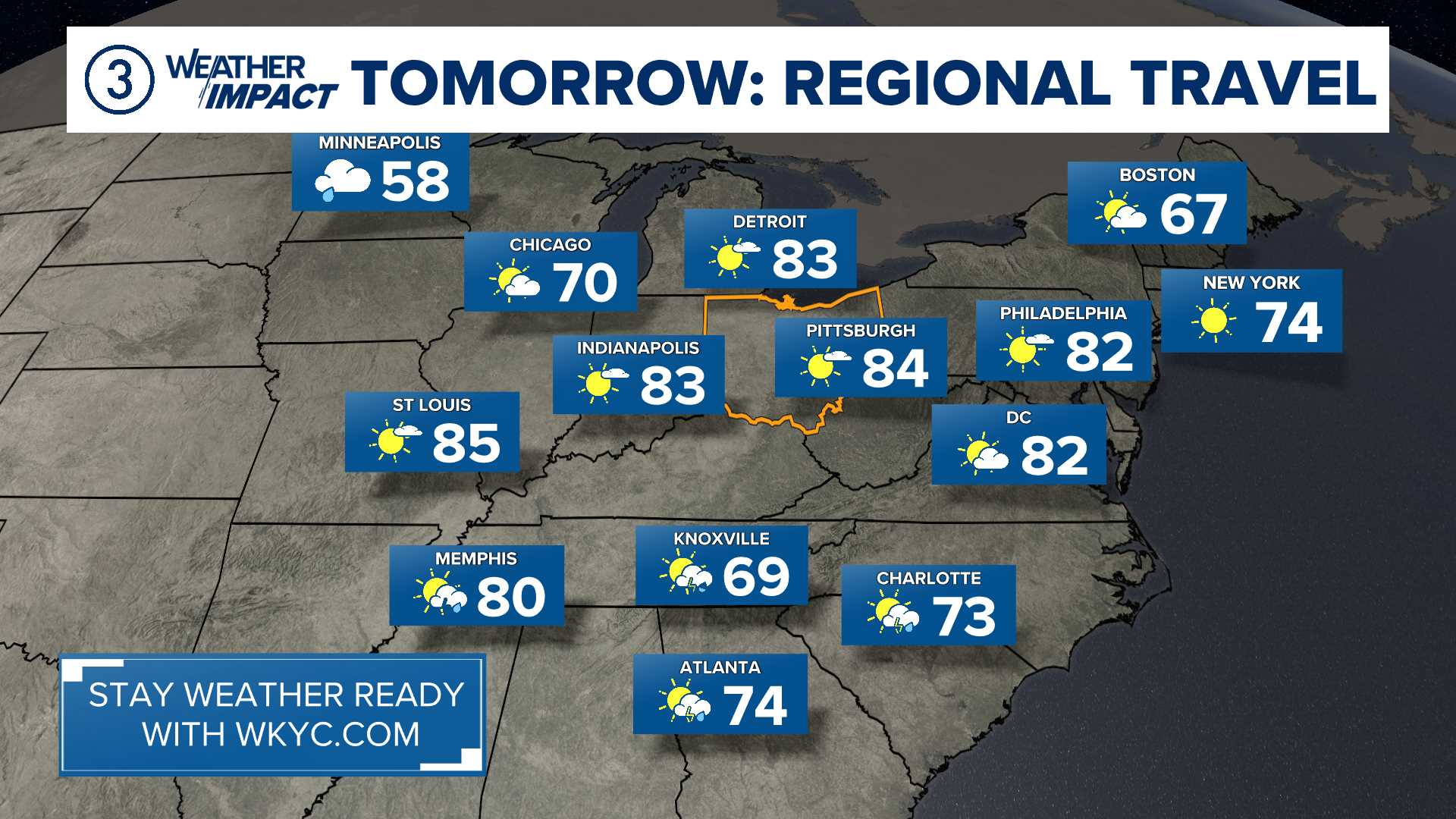
YOUR TRAVEL FORECAST:
---
Follow the Channel 3 Weather Team on Twitter @wkycweather and on Facebook