
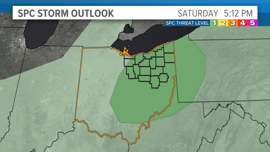
CLEVELAND — More spotty showers are in the forecast Sunday - lucky us! However, this go-around Sunday's thundershowers will have better organization with their momentum and timing due to an inbound cold front.

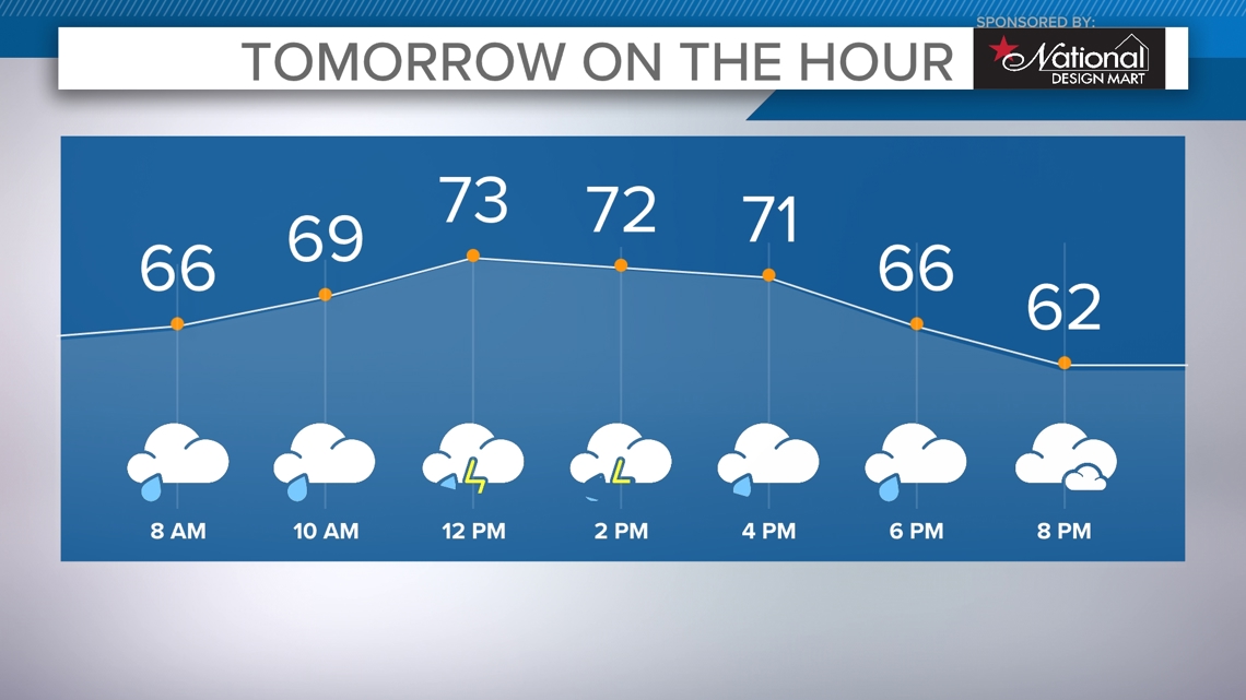
Out the door Sunday, most of us will be greeted with peeks of sunshine. Partly cloudy to mostly cloudy skies will be likely through midmorning. Thundershowers will be bubbling up fast by lunchtime east of the metro. There is an isolated threat of strong winds as storms fire up along the front. Showers and storms will be likely through the afternoon and early evening.

Showers will move out after sunset Sunday. Monday is still looking like the best day of of the work week. Another round of damp weather rolls back in come Tuesday.
THE 3 DAY FORECAST
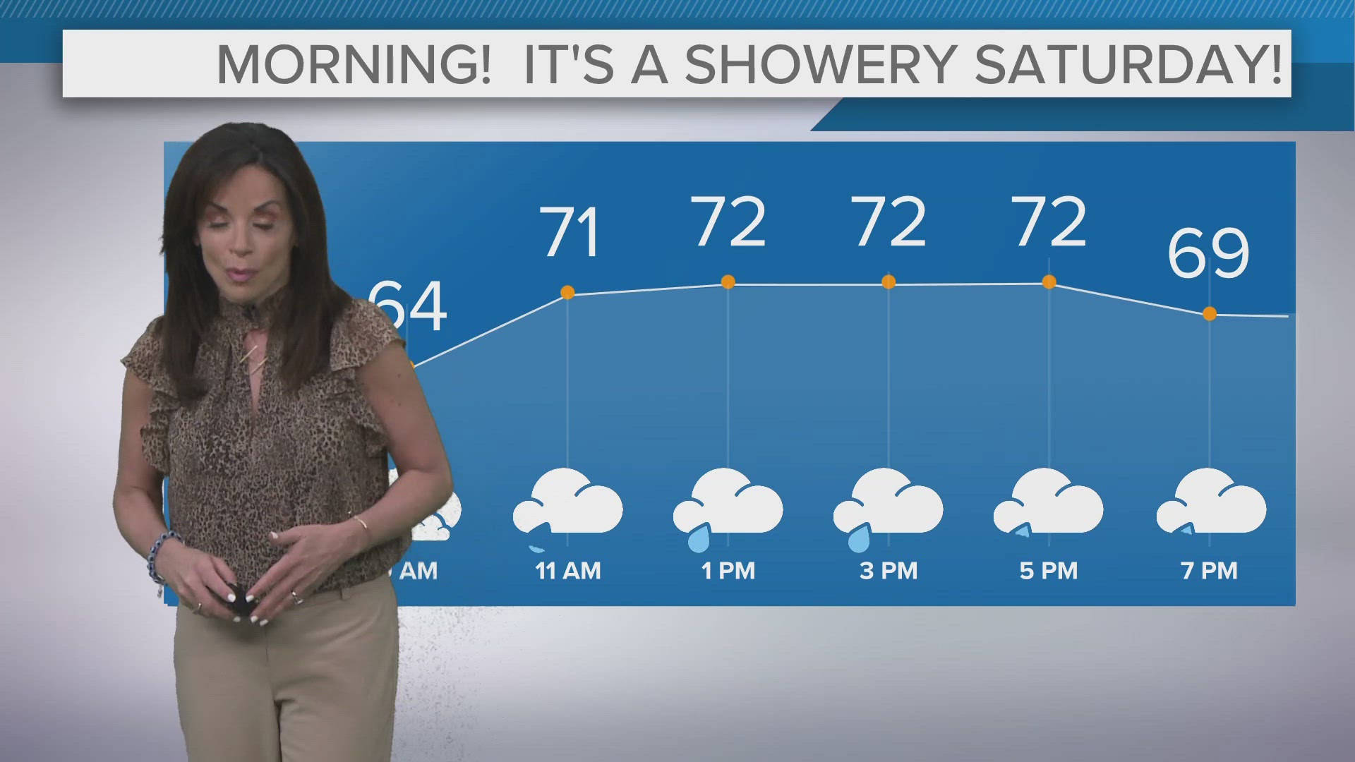
TONIGHT: Isolated showers early. Partly cloudy. Low 60s
SUNDAY: Afternoon scattered showers and thunderstorms. Low 70s
MONDAY: Partly cloudy, isolated rain south. Upper 60s
TUESDAY: Partly cloudy, PM thunderstorms. Low 70s
Here are some quick weather resources you can use:
---------------------------------------------------------------------------------------------------
Get more weather from the 3News Weather team of Betsy Kling (@betsykling), Matt Wintz (@WintzWeather), Anthony Copeland (@WeatherManAC) and Hollie Strano (@holliesmiles)
►MORE WEATHER | Get the latest weather headlines, video, photos & more
►ENVIRONMENT NEWS | Find out more about the world around us
►EARTH & SPACE NEWS | Learn more about our planet and outer space
►WEATHER FEATURES | Read our weather guides, storm reports & more
MORE WEATHER-RELATED HEADLINES: